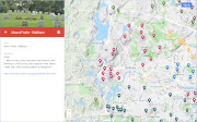
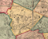
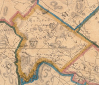
| Hills of Waltham, Mass. |
| | Hills | More about Waltham's USGS-listed hills | Maps | Sources | |
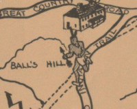
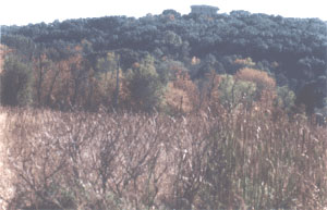
| Balls Hill |
| • |
Google Maps | Google Earth - Google |
| • |
"...The last house in Waltham on the Main road was the Bemis Tavern, owned and occupied by Isaac Bemis as a tavern in 1798,
and kept by him for a long time. John Ball is supposed to have occupied the stand previous to him, and a Mr. Stratton followed
him. It is still standing, the only one of the ancient taverns left but no longer a public house...", Nelson, pg. 90, 1879 - Internet Archive |
| • |
"...They breakfasted in the old tavern on Ball's Hill, in its day one of the most important taverns in Massachusetts, but now gone to decay and condemned...", Lawson, pg. 20, 1913 - HathiTrust |
|
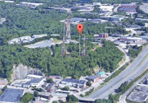
| Bear Hill |
| • |
USGS identified - MassMapper MassGIS |
| • |
Google Maps | Google Earth - Google |
| • |
"...Bear Hill is best known from 128 traffic reports as a point of congestion that is marked by a forest
of antenna towers and has very limited public access. ...", City of Waltham Massachusetts, 2015 - 2022 Open Space & Recreation Plan, pg. 7, (PDF) - City of Waltham |
| • |
"...It contains Prospect Hill, 482 feet in height, Bear Hill and Helmet Hill, and has many pleasant walks and drives...", Pg. 139, Historic Boston: Sight-seeing Tours Around the Hub, 1901 - "...Google ebook |
| • |
Bear Hill - USGS Geographic Names Information System |
|
| Beehive Hill |
|
| Boston Rock Hill |
| • |
Google Maps | Google Earth - Google |
| • |
"..Most of them probably didn't realize that Brandeis was located on Boston Rock, the highest point of land due west from the heart of what is metropolitan Boston. It was from Boston Rock that Governor John Winthrop had surveyed the site of the future city more than three hundred years earlier...", Brandeis University: A Host at Last, pg. 37, Abram L. Sachar, 1995 - Google ebook preview |
|
| Cedar Hill |
| • |
USGS identified - MassMapper MassGIS |
| • |
Google Maps | Google Earth - Google |
| • |
Ephraim Hammond House, "...The old Hammond lands were greatly improved after their purchase by Cornelia Otis Warren's father during the mid-19th century...The Warren family's Waltham estate was called Cedar Hill..." - Massachusetts Cultural Resource Information System (MACRIS) |
| • |
"...Situated on the western side of the Girl Scout camp is another Cornelia Warren bequest, the 15-acre Waltham Woods. Owned by the City of Waltham, the peak of Cedar Hill here offers fine views to the south....", The Western Greenway- Waltham Land Trust |
| • |
"...Situated on the western side of the Girl Scout camp is another Cornelia Warren bequest, the 15-acre Waltham Woods. Owned by the City of Waltham, the peak of Cedar Hill here offers fine views to the south....", The Western Greenway- Waltham Land Trust |
| • |
"...The State Girl Scout headquarters are housed in the spacious mansion on Cedar Hill, left for the purpose by Miss Cornelia Warren...", Waltham, Massachusetts City Directory, R.L. Polk, 1943, pg. 11 - Internet Archive |
| • |
Cedar Hill - USGS Geographic Names Information System |
|
| Echo Rock |
|
| Fiske Hill |
| • |
Google Maps | Google Earth - Google |
| • |
Auburndale Boating Map 1870, Historic Maps of Newton - City of Newton, Massachusetts |
| • |
Perhaps - Elijah Fiske House, "...Luke Fiske (1794-1845) was one of the most prominent men in Waltham of his time: chairman of the Board of Selectmen, an assessor, Representative to the General Court in 1838, end the first president of the Waltham Bank..." - Massachusetts Cultural Resource Information System (MACRIS) |
| • |
Perhaps - Nathan Fiske, Sr., "...He was a resident of Watertown, Middlesex County, Massachusetts as early as 1642 and was admitted as a freeman on May 10, 1643. He bought land there on October 7, 1643..." - An American Family History |
|
| Grove Hill |
| • |
Google Maps | Google Earth - Google |
| • |
Grove Hill Cemetery - Wikipedia |
| • |
Grove Hill Cemetery , "...On October 23, 1704, land included in the present burial ground was purchased by the Middle Meetinghouse's Society. The cemetery's original 2.3 acres are said to have been part of a 4 acre lot granted to Edmund Blois before 1640. Near the center of the cemetery, near the (northern) base of the hill was Potters Field, 'where strangers were buried' and presumably indigent Waltham citizens. This cemetery was called the Old Burying Ground until it was renamed Grove Hill in the late 19th century..." - Massachusetts Cultural Resource Information System (MACRIS) |
|
| Jericho Hill |
| • |
Google Maps | Google Earth - Google |
| • |
"...The City has also acquired the former Sanderson Heights (26.26 acres) off Lincoln Street, and a portion of Jericho Hill (6 acres), as well as Chesterbrook Woods (26 acres) off Lexington Street...", City of Waltham Massachusetts, 2015 - 2022 Open Space & Recreation Plan, pg. 7, (PDF) - City of Waltham |
| • |
Our View on Lincoln Woods, "...Lincoln Woods is a 26-acre parcel forming the western flank of Jericho Hill, the highest point in the city outside of Prospect Hill Park...." (PDF), 2004- Waltham Land Trust |
| • |
"...The Stigmatine Fathers’ property occupies the east side of a local summit called Jericho Hill. An adjacent wooded site of comparable size on the west side of Jericho Hill (“Lincoln Woods”) is currently the subject of a heated debate between hopeful developers and local abutters, playing out before the City’s Planning Board. Between these two parcels, at the summit of Jericho Hill itself, the City of Waltham purchased six acres in June, 2003, to prevent its development...." (DOC), - The Espousal Center: Reaching Out, Welcoming In, 2004 |
|
| Little Prospect Hill |
| • |
Google Maps | Google Earth - Google |
| • |
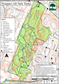
Prospect Hill Park (PDF), "...At 485 feet, the higher summit, Big Prospect, is the second highest point in the vicinity of Boston. The lower summit, which measures 435 feet, is known as Little Prospect...." - Waltham Land Trust |
| • |
"...Waltham’s most unique geological features that are the prominent in Prospect Hill Park, where exposed
outcroppings are known as Big Prospect and Little Prospect. The higher summit, Big Prospect is the
second highest point in the vicinity of Boston at 485 feet. The lower summit, which measures 435 feet is
known as Little Prospect....", City of Waltham Massachusetts, 2015 - 2022 Open Space & Recreation Plan, pg. 30 , (PDF) - City of Waltham |
|
| Mackerel Hill |
| • |
Google Maps | Google Earth - Google |
| • |
Beaver Brook North Reservation and Mackerel Hill (PDF), "...Many of the Reservation’s place names originated between 1632 and 1650: Rock Meadow, West Meadow, and Mackerel Hill. Though heavily wooded in the 17th century, by the mid-19th century most trees in the area had been cut down for tillage and pasture lands. Some of the last, in the Mackerel Hill pine forest, were chopped down in 1892...", Trail Map . - Waltham Land Trust |
| • |
Mackerel Hill, "...Named in 1650, possibly for a town in England, much of this 300-foot hill located along Trapelo Road is included in the DCR Beaver Brook North Reservation...." - Waltham Land Trust |
| • |
"...Mackerel Hill, near the N.E. corner of the town, is less elevated, but commands a beautiful prospect, includ
ing Boston harbor. It has borne this name from a very early date.. " - Bond, pg 1031, 1860 - Internet Archive |
| • |
Mackerel Hill, Historic hills of Waltham - Waltham Land Trust |
|
| Mount Enoch |
| • |
Google Maps | Google Earth - Google |
| • |
"...Mount Enoch, also on Wellington lands, is the highest of the Trapelo Hills, and offers fine views from its summit to the north and west... ", Nelson, pg 81, 1879 - Internet Archive |
| • |
The Western Greenway, "...A stream draining from Mount Enoch (location of the Northeast Elementary School) crosses through the site, and connects with Clematis Brook..." - Waltham Land Trust |
|
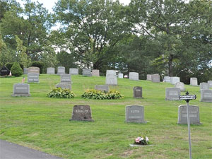
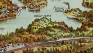
| Mount Feake |
| • |
USGS identified - MassMapper MassGIS |
| • |
Google Maps | Google Earth - Google |
| • |
"...The first hill within the ancient limits of Watertown, that is noticed in the early records, is Mount Feake, named for Mr. Robert Feake, of Watertown. It was discovered and named by Governor Winthrop and his exploring party, in January, 1631-2. It is too insignificant in magnitude to be entitled a mount, or even to be thus noticed as a hill; and the party must have been in a jocose mood, when they gave it its designation
and importance... ", Bond, pg 1031, 1860 - Internet Archive |
| • |
"...Mount Feake was marked upon a plan of the town made in 1640, only eight years after the name was given, which plan was unfortunately destroyed by fire in Boston in 1825; it has retained its name, and a beautiful cemetery has been laid out upon its western slope... ", Nelson, pg 28, 1879 - Internet Archive |
| • |
"...Mount Feake, the first hill spoken of in the early records of the town, named for
Robert Feake, is insignificant in magnitude, and has been nearly obliterated for the grading of a railroad...", Drake, pg. 434, 1880 - Internet Archivce |
| • |
Mount Feake Cemetery, "...The cemetery derived its name from that given to the highest hill within Waltham's limits by Governor John Winthrop in 1632. The hill was named for Robert Feake who married Winthrop's daughter. The rise of the ground west of Mount Feake was called Winthrop Hill..." - Massachusetts Cultural Resource Information System (MACRIS) |
| • |
Gov, Winthrop's Outing to Doublet Hill in 1631, "...It seemed a great stretch to call Boston Rock Hill, a good half mile northwest, a high rock on the west side of Mt. Feake, in the cemetery. From it one does not see Nipmuck...", E.G. Chamberlain, Appalachia, Vol 13, pg. 140, Appalachian Mountain Club, 1914 - Google ebook |
| • |
Mount Feake - USGS Geographic Names Information System |
|
| Owl Hill |
| • |
USGS identified - MassMapper MassGIS |
| • |
Google Maps | Google Earth - Google |
| • |
"...Buildings and roadways are present on the Property (which is shown as the Fernald State School), on the west side of Owl Hill...", 1947 Historical Topographic Maps, 1947 - Draft Phase I Environmental Site Assessment, Fernald Developmental Center, pg. 47- City of Waltham |
| • |
"...The site features a 250-foot elevation on Owl Hill, a varied terrain with some steep slopes... ", Environmental Report Fernald Reuse Committee, 2009 - City of Waltham |
| • |
"...Owl or Helmet Hill in the east part of the city is a drumlin...", Boston Through the Ages, The Geological Story of Greater Boston, pg. 141, Irving B. Crosby, 1928 - Internet Archive |
| • |
"...This comprises the loverly pastoral landscape, with the remarkable formation, originating with the glacial period, known as a 'kane' -- a long serpentine ridge, running out from the shoulder of Helmet Hill, close by, and losing itself in the meadow coursed by Beaver Brook...", pg. 164, Transactions of the Massachusetts Horicultural Society for the year 1894 - "...Google ebook |
| • |
"...It contains Prospect Hill, 482 feet in height, Bear Hill and Helmet Hill, and has many pleasant walks and drives...", Pg. 139, Historic Boston: Sight-seeing Tours Around the Hub, 1901 - "...Google ebook |
| • |
Owl Hill - USGS Geographic Names Information System |
|
| Pigeon Hill |
| • |
Google Maps | Google Earth - Google |
| • |
"...Upon the old Brown estate is situated Pigeon Hill, so named from its having been formerly the resort of pigeons in large numbers. Three or more times within
the past century a hospital has been established here for those afiflicted with the small-pox... ", Nelson, pg 80, 1879 - Internet Archive |
| • |
"...
Key for Waltham residents are the significant hills that serve as wayfaring points, neighborhood names and scenic landscapes including: Prospect Hill, Mackerel Hill, Trapelo Hill, Jericho Hill, Bear Hill, Owl Hill, Pigeon Hill and Stearns Hill....", City of Waltham Massachusetts, 2015 - 2022 Open Space & Recreation Plan, pg. 19, (PDF) - City of Waltham |
| • |
"...and Pigeon Lane went from the gateway of S.D. Warren's estate over Pigeon Hill to Trapelo...", Proceedings at the Celebration of the Sesqui-centennial of the Town of Waltham, pg.30, 1888..- Google ebook |
|
| Prospect Hill |
| • |
USGS identified - MassMapper MassGIS |
| • |
Google Maps | Google Earth - Google |
| • |
Prospect Hill Park (PDF). "...At 485 feet, the higher summit, Big Prospect, is the second highest point in the vicinity of Boston. The lower summit, which measures 435 feet, is known as Little Prospect...." - Waltham Land Trust |
| • |
Prospect Hill, "...First mentioned in 1669, this 482-foot hill is the second highest in the Metropolitan Boston area. At the instigation of Charles Eliot, a 250-acre park was set aside for public pleasure in 1893. ...." - Waltham Land Trust |
| • |
Prospect Hill Park: Its Creation, Decline, and Renewal (PDF), "...More recently (only 20,000 years ago), the shape of the hill was altered by glaciation. The same continental glacier that formed the drumlins in the Boston Basin also shaped Prospect Hill... ", Elizabeth M. Lowe - Grove Hill Gardens |
| • |
The Old Stone Walls of Prospect Hill Park (PDF), "...It should also be mentioned that [Edmund L] Sanderson determined that the name “Prospect Hill” dates from at least 1669. .... ", Morton S. Isaacson, 2016 - Waltham Historical Commission, Waltham Historical Society |
| • |
"...The highest and most conspicuous is Prospect Hill, about half a mile west of Waltham Plain. It rises with a regular rounded surface, like the back of a porpoise, to the height of 482 feet above tide-water. A large pine tree formerly stood on its summit, and it was one of the first points seen by mariners ou approaching Boston harbor. It commands a very wide, diversified, and beautiful prospect. In an ancient record it is called Knapp's Garden.... ", Bond, pg 1031, 1860 - Internet Archive |
| • |
"...Among the immigrants who came over with Sir Richard Saltonstall in 1630 were two men, perhaps brothers, named Nicholas and William Knapp, who, with others, became the first settlers of Watertown, Mass.. ...", Arthur M. Knapp, 1909, pg. 12, The Knapp Family in America: A Genealogy of the Descendants of William Knapp who settled in Watertown, Mass., in 1630 - Internet Archive |
| • |
"...Waltham’s most unique geological features that are the prominent in Prospect Hill Park, where exposed
outcroppings are known as Big Prospect and Little Prospect. The higher summit, Big Prospect is the
second highest point in the vicinity of Boston at 485 feet. The lower summit, which measures 435 feet is
known as Little Prospect....", City of Waltham Massachusetts, 2015 - 2022 Open Space & Recreation Plan, pg. 30 , (PDF) - City of Waltham |
| • |
Prospect Hill, Historic hills of Waltham - Waltham Land Trust |
| • |
Prospect Hill Park Master Plan (PDF), 1997 - City of Waltham |
| • |
Prospect Hill - USGS Geographic Names Information System |
|
| Reservoir Hill |
| • |
USGS identified - MassMapper MassGIS |
| • |
Google Maps | Google Earth - Google |
| • |
"...1873 - Waltham's original water supply, the Charles River, is filtered and pumped by steam to a 6 million gallon open reservoir on land now owned by Brandeis University....", Key dates in the history of Waltham, Massachusetts - Waltham Massachusetts Community |
| • |
"...However, Usdan is not without its own distinctions. “Usdan is actually built on the site of an old City of Waltham reservoir, and a plane did crash there a number of years before the building’s construction in 1970,” Baker said. McNeely said the reservoir held 6 million gallons of water, but was eventually drained and filled when it fell out of use in order to make way for the building....", Debunking Urban Legends about Brandeis Architecture, Debunking: Brandeis Urban Legends, Robin Lichtenstein, 2009 - The Brandeis Hoot |
| • |
"...Usdan Student Center was built on the former Middlesex Reservoir....", Debunking Urban Legends about Brandeis Architecture, 2009 - From the Brandeis Archives |
| • |
Reservoir Hill - USGS Geographic Names Information System |
|
| Snake Rock |
| • |
Google Maps | Google Earth - Google |
| • |
"...Opposite the Stony Brook depot is a hill, called Snake Rock, from the rattlesnakes which used to abound at the foot of its precipitous western side... ", Nelson, pg 106, 1879 - Internet Archive |
| • |
Snake Rock, "...To get to Snake Rock, you located the dirt path entry close to where the school building spilled out onto the basketball court...", John Regan, 2017 - Waltham Boy |
|
| Stearns Hill |
| • |
Google Maps | Google Earth - Google |
| • |
"...
Key for Waltham residents are the significant hills that serve as wayfaring points, neighborhood names and scenic landscapes including: Prospect Hill, Mackerel Hill, Trapelo Hill, Jericho Hill, Bear Hill, Owl Hill, Pigeon Hill and Stearns Hill....", City of Waltham Massachusetts, 2015 - 2022 Open Space & Recreation Plan, pg. 19, (PDF) - City of Waltham |
| • |
Perhaps - Isaac Stearns (1595-1671) "...The Arbella arrived in Salem, Massachusetts, on June 12, 1630, but the passengers disliked the location as a place for a permanent settlement, so they proceeded to Charlestown and were among the first settlers of Watertown...", - Wikipedia |
| • |
Genealogy and Memoirs of Isaac Stearns and his Descendants, Avis Stearns Van Wagenen, 1901 - Internet Archive |
|
| Stratton Hill |
|
| Trapelo Hill |
| • |
Google Maps | Google Earth - Google |
| • |
"...
Key for Waltham residents are the significant hills that serve as wayfaring points, neighborhood names and scenic landscapes including: Prospect Hill, Mackerel Hill, Trapelo Hill, Jericho Hill, Bear Hill, Owl Hill, Pigeon Hill and Stearns Hill....", City of Waltham Massachusetts, 2015 - 2022 Open Space & Recreation Plan, pg. 19, (PDF) - City of Waltham |
| • |
"...Trapelo traces its name from no reliable origin, though it is supposed or imagined that the word may be a corruption of the words 'trap below," used to localize a place of trapping. It is to be regretted that this historical and expressive name is
not officially recognized in any local designation.... " - Hurd, pg 704, 1880 - Internet Archive |
|
| Winthrop Hill |
| • |
Google Maps | Google Earth - Google |
| • |
Mount Feake Cemetery, "...The cemetery derived its name from that given to the highest hill within Waltham's limits by Governor John Winthrop in 1632. The hill was named for Robert Feake who married Winthrop's daughter. The rise of the ground west of Mount Feake was called Winthrop Hill. ..." - Massachusetts Cultural Resource Information System (MACRIS) |
| • |
"...The new entrance at Prospect street and the grading on Winthrop Hill are the most important items... " - Inaugual Address for Hon. Murray D. Clement, with the Annual Reports, 1902, pg. 253 - Google ebook |
| • |
"...Surveys were made for the development of a new tract in Mount Feak lying easterly from Winthrop Hill but owing to lack of time, the design was not completed... " - Inaugual Address for Hon. George R. Beal, with the Annual Reports, 1917, pg. 114 - Google ebook |
| • |
Mount Feake & Grove Hill Cemetery Map - City of Waltham |
|
|
|
 |
|
 |
|
 |
|
 |
|
 |
|
 |
|
 |
|
 |
|
 |
|
 |
|
| Balls Hill |
 |
|
| Bear Hill |
 |
|
| Boston Rock Hill |
 |
|
 |
|
| Mackerel Hill |
 |
|
| Mount Feake |
 |
|
 |
|
 |
|
| Prospect Hill |
 |
|
 |
|
 |
|
| |
|
|
| More about Waltham's USGS-listed hills |
|
There is no record of what was the very first hill the Europeans named when they settled in the Boston Basin. One of the very earliest was Mount Feake. In the winter of 1631/1632 Puritan leader John Winthrop (1587-1649) was confident enough of his new colony’s survival that he could go exploring. On January 27th he started up the Charles River leading an expedition to plan a public road westward. Winthrop kept a journal, writing in the third person, he notes, “The governor, and some company with him, went up by Charles River about eight miles above Watertown…”, there they crossed two brooks and came to a, ”high pointed rock, having a fair ascent on the west side, which they called Mount Feake, from one Robert Feake, who had married the governor's daughter-in-law. On the west side of Mount Feake, they went up a very high rock, from whence they might see all over Neipnett, and a very high hill due west, about forty miles off, and to the N. W. the high hills by Merrimack, above sixty miles off.” Neipnett, or Nipmuck, describes an area, and the Native Americans, who lived in central Massachusetts. |
| One would think that there would be no question about the location of Mount Feake (138 ft.). There should be a statue on its summit, or at least a plaque. Mount Feake could be the first named hill in the Boston Basin, there was no beacon on Beacon Hill until 1635. The USGS lists a Mount Feake and locates it next to the Charles River in Waltham. The Massachusetts Historical Commission and the National Park Service agree putting its location in the Mt. Feake Cemetery. But not everyone agrees. In 1813 Samuel Kendal (1753-1814), a minister of the First Church at Weston, gave a sermon to mark the 100th anniversary of his town where he speculated that the second brook the Winthrop party passed, the larger of the two, was likely today’s Stony Brook.1 That would mean that Mount Feake would be in Weston, not Waltham. Samuel Ripley (1783-1847), the minister at the First Parish Church in Waltham would have none of that. In 1815 he penned an anonymous article for the Massachusetts Historical Society where he states that the second larger brook was not Stony Brook, rather a brook in Waltham that was smaller now because “the lands about its source were cleared and cultivated, its spring have been gradually filled till they are almost stopped.” A rather weak explanation. |
| In 1857 Waltham laid claim to their hill being the real Mount Feake by opening a town cemetery on the hill and calling it the Mount Feake Cemetery. For good measure they named a small hill on the grounds Winthrop Hill. Weston’s claim to Mount Feake was gone. It appears not everyone was happy with Waltham’s claim. Henry Bond, writing in an 1860 history of Watertown, notes that the hill, “It is too insignificant in magnitude to be entitled a mount, or even to be thus noticed as a hill; and the party must have been in a jocose mood, when they gave it its designation and importance.” Daniel S. Lamson (1793-1912), in a history of Weston published after his death, made an argument that Sanderson’s Hill in Weston was the real Mount Feake.2 But in 1890 the official USGS Massachusetts Topographical map was published with Mount Feake clearly labelled in Waltham. |
|
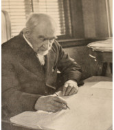
There would be one more effort to identify the true location of the hill John Winthrop named Mount Feake after his son-in-law, and it would come not from a citizen of Watertown or Weston, but from a man known as a master surveyor and cartographer. Edward G. Chamberlain (1845-1935) was one of the Appalachian Mountain Club’s earliest members.3 His survey of the Blue Hills in 1885 was the first detailed map of area and would be used as a source for many of the names of the hills when it became a park in 1893.4 In a 1915 article in the AMC’s publication Appalachia, he writes that he was “perplexed” by the description of the hill in Winthrop’s journal not matching that of Waltham’s Mount Feake.5 Even assuming some leveling for a nearby railroad line, Mount Feake was not a “high pointed rock,” and the mountains to the west would never have been visible from its west side. His mapping of the topography led him to identify an unnamed hill in Weston as the real Mount Feake. Because of its double summits he called it Doublet Hill. Chamberlain didn’t comment on or suggest changing the name of Mount Feake in Waltham, but he must have been satisfied that he identify the real hill John Winthrop climbed, and Doublet Hill is recognized as a USGS-listed hill. |
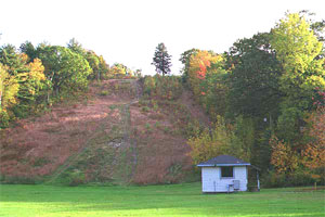
| USGS-listed Prospect Hill (446 ft.) is the third tallest hill in the Boston Basin (Note: more modern surveys put its height at 485 ft.). Two hills in the Blue Hills Reservation, Great Blue Hill (594 ft.) and Chickatawbut Hill (502 ft.), are taller. Prospect Hill is not an uncommon name, Lynn and Somerville both have one. Newton did have one but changed its name to Waban Hill. The name can mean a “fair view” of the surroundings, or from the Latin, prospectus, "distant view, look out." In a history of Watertown written in 1860, the author notes that Prospect Hill, “in an ancient record it is Knapp’s Garden.” But says nothing else. There were two Knapp’s, possibly brothers who, in 1630, were among the first settlers of Watertown. William Knapp (c.1578-1658) stayed in the area. There is no record of him or any of his descendants living on or near the hill. |
| Bear Hill (282 ft.) has been called by that name dating to the time before Waltham split off from Watertown. Like with other Bear Hills in the Boston Basin, the name could be based on a larger than normal number of bears on that one hill, or it could be there was “bare” area at the summit. As noted above, Bear Hill and its taller companion Prospect Hill, just to the north and east, were commonly identified on early maps as the two major hills in Waltham. Still a rural area in the late 1800s, landscape architect Charles Eliot proposed, as part of a report to the newly formed Metropolitan Park Commission, that a reservation similar to the Middlesex Fells and the Blue Hill be created that would include Prospect Hill, Bear Hill, and Doublet Hill in Weston. The land was available. No longer needed as wood-lots for lumber, the flatter areas around the hills had just begun to be subdivided for houses. But the opportunity passed. The Waltham Park Department purchased the steeper rocky land on Prospect Hill and would turn that area into a park. But he state didn’t step in to buy the land needed to create a larger park. The pressure for development was too strong. Though it wouldn’t be until the 1950s that Route 128 would split Prospect and Bear Hills forever eliminating the possibility of larger park. |
| USGS-listed Cedar Hill (220 ft.) is best known for the Girl Scout camp established there in 1923, and Bentley University, which moved its campus to the hill in 1962. Most of the land on and around the hill was part of the estate of Samuel D. Warren (1817-1888), and it is thought he named it Cedar Hill.7 His story is the quintessential American rags-to-riches tale, where rags are part of the story. Born in Grafton, Mass. The sixth of 14 children, his father died when he is eleven. In 1832, at 15, he moved to Boston and gets a job at a paper dealer. By age 21 he was made a partner in the company. In 1854 the company buys a small paper mill in Maine. A decade later Warren is the sole owner of the company, and the mill. Today you can go to an office supply store and buy high-quality cotton paper, sometimes known rag as paper. Up until the mid-1850s almost all paper was made by beating down cotton rags into pulp. Warren was one of the first mill owners to start using a new process that blended wood chips with rags to make the pulp. By 1880 he had the largest paper mill in the world. A very religious and ethical man, Warren introduced labor management policies that would help revolutionize concepts of labor relations in the United States. For employees at his mill complex in Westbrook, Maine he paid fair wages, offered low-cost housing, a relief fund for disabled workers, training when new machinery was introduced, he built schools, churches, a public hall and library. His relations with employees were so good the company avoided almost all of the labor unrest of the late 1800s, and Warren became a pioneer it would become known as “welfare capitalism.” |
| The Warren estate on Cedar Hill was willed to Cornelia Warren (1857-1921). She was one of five children of Samuel and his wife Susan C. Clarke (1825-1901). Her life, and those of her four brothers, included noble work done in private and public, as well scandalous inter-family fighting. All five siblings received the best in educational opportunities, the oldest son, also named Samuel D. Warren (1852-1910) graduated from Harvard Law School near the top of his class.8 After graduation he formed a law firm with Louis D. Brandeis (1856-1941), the future Supreme Court Justice, and the man who was ranked just above him in law school. Samuel continued to run the family company with the same benevolent hand as his father, and also co-authored with Brandeis the seminal legal article entitled “The Right to Privacy.” The work of Brandeis and Warren is considered the first to argue that “the right to be left alone” should be protected by law. The issue would have tragic results for Samuel after a lawsuit filed by his younger brother Edward P. Warren (1860-1928) accused him of defrauding the family of their father’s wealth.9 Because of the family’s great wealth, the case played out in the public eye. The pressure became too great for Samuel and he committed suicide in 1910. Along with the filing the lawsuit against his brother possibly leading to his death, Edward’s legacy was further scandalized by the publication after his death of a three-volume book, “A Defence of Uranian Love” where he advocated for the practice of pederasty. |
| Henry Clarke Warren (1854–1899), the second son of Samuel and Susan, suffered a serious accident when he was a child falling off a horse-drawn carriage. Severe spinal injuries left him disabled and in pain for the rest of his life.10 Overcoming obstacles, he graduated from Harvard and became a scholar of Sanskrit and then went on to receive distinction an author and authority on Buddhism. The house he purchased and lived in near Harvard University still stands. He specially outfitted it to make it easier for him to deal with his chronic pain and disability. The youngest of the brothers was F. Fiske Warren (1862-1938) was also Harvard educated and received a law degree from Oxford University in England.11 He took his father’s idea of a benevolent boss one step further and was a proponent of a popular movement of the time called “Single Tax” where the land was owned by the community and a single tax that is based on the value of the land pays for community services. Using his wealth established several “Single Tax enclaves” including Tahanto in Harvard, Mass., Halidon in Westbrook, Maine, and another, astonishingly, in the small Pyrenees mountain country of Andorra on the Spanish/French border. Eventually after Fiske’s death, the land was privatized. |
|
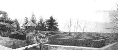
The fact that of much of Cedar Hill is undeveloped is thanks to Cornelia Warren (1857-1921), Samuel and Susan’s one daughter.12 She lived the life of a wealthy Boston Brahmin, private tutoring by professors from Harvard and MIT, studying music in France, travels through America, Mexico, Europe, North Africa, and Asia buying art, time to write two books and poetry, homes on Beacon Hill and the mansion in Waltham on Cedar Hill. She was also one of the best-known and most generous philanthropists in New England at the time. The list of organizations she supported with charitable donations was extensive. She paid for the creation the Desnison House in Boston, one of the first settlements in the country providing social and educational service to immigrant women. At the town where her father’s paper mill was located what she funded included, a school, library, gymnasium, swimming pool, parks, and other property for educational and recreational purposes. She was a trustee and Wellesley College and the Bradford Academy, one of the first all-girls schools in New England. She gave liberally to the Waltham Hospital, and Waltham Girls’ Club. On her Cedar Hill estate, she ran a model farm and, in another part, planted one thousand tree and took ten years to construct an elaborate maze patterned after one in England. Then she opened it to the public. When she died, her will stated that the property be used for agricultural and educational purposes. The trustees bequeathed land to the Massachusetts Girls Scouts, Massachusetts Agricultural College, Harvard School of Landscape Architecture, and the city of Waltham. |
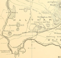
| It is not clear how USGS-listed Owl Hill (223 ft.) got its name. The hill appears labelled with that name in the 1890 Massachusetts State Topographic Atlas. Other maps have labelled the summit Helmet Hill and Crown Hill. The Massachusetts School for the Feeble Minded, later renamed the Fernald School, was opened on its summit in 1889. |
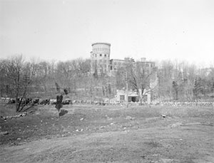
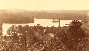
| USGS-listed Reservoir Hill (177 ft.) does not appear on any USGS topographic maps until the 2015 National Map. There are no references to geological surveys the USGS-GNIS citation. Instead, like more than a few other hills on the northern rim of the Boston Basin with questionable locations, the citation is Aden T. Vaughan and his 1965 book, which doesn’t mention the hill. There was once a reservoir on the hill. Built in 1873, it held 6 million gallons of water and was located near a building on what is now the Brandeis University campus called the Castle. The Usdan Student Center was built over the site in 1970. Unfortunately, the location of former reservoir does not match the coordinates given for the USGS Reservoir Hill. The former reservoir is near the location on what is known as Boston Rock Hill on the east side of the campus. The Reservoir Hill identified by Vaughan is 2,500 feet to the west-southwest on the western side of the hill. The location overlooks the Stony Brook Reservoir and it is possible Vaughan chose the location for that reason. No map or historical records identify a hill in that location. |
|
|
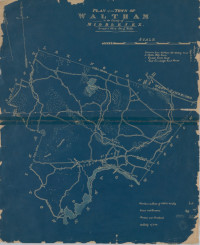
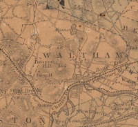
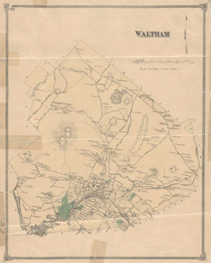
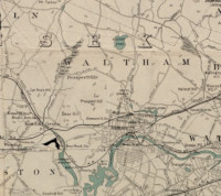
| Waltham Maps |
| • |
Waltham - Google Maps, Terrain |
| • |
Waltham - MassMapper MassGIS |
| • |
Waltham - USGS - The National Map |
| • |
Concord Quadrangle - 2018 (60 MB PDF) - USGS Topo Download |
| • |
Lexington Quadrangle - 2018 (60 MB PDF) - USGS Topo Download |
| • |
Natick Quadrangle - 2018 (60 MB PDF) - USGS Topo Download |
| • |
Newton Quadrangle - 2018 (60 MB PDF) - USGS Topo Download |
| • |
1890 Topographicsl Atlas of Massachusetts,
Boston Sheet - Librry of Congress, David Rumsey
Framingham Sheet - Library of Congress, David Rumsey |
| • |
Plate 4, Atlas of Massachusetts, O.W. Walker, 1891 - David Rumsey Map Collection |
| • |
Historical Maps of Waltham - City of Waltham |
| • |
Maps of Walthan, Mass - Digital Commonwealth |
| • |
Walthan, Atlas of Middlesex County, Volume 1, published by Geo. W. Stadly & Co., 1900 - State Library of Massachusetts |
| • |
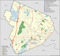
Waltham, MA - Unique & Scenic Features, City of Waltham Massachusetts, 2015 - 2022 Open Space & Recreation Plan, pg. 22 , (PDF) - City of Waltham |
| • |
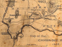
Atlas of the boundaries of the cities of Cambridge, Somerville, Waltham and towns of Belmont, Burlington, Lexington, Watertown, Middlesex County, 1903 - State Library of Massachusetts |
|
|
| Waltham Sources |
| • |
A Topographical and Historical Description of Waltham, in the County of Middlesex, Jan. 1, 1815, Collections of the Massachusetts Historical Society, Vol. 3, pg., 1815 - Google ebook |
| • |
Waltham, Past and Present; and its Industries, Charles A, Nelson, 1879 - Internet Archive |
| • |
Waltham, History of Middlesex County, Massachusetts: Containing Carefully Prepared Histories of Every City and Town in the County, Samuel A. Drake, 1880 - Internet Archive |
| • |
Proceedings at the Celebration of the Sesqui-centennial of the Town of Waltham, 1888 - Google ebook |
| • |
Waltham, History of Middlesex County, Massachusetts, with Biographical Sketches of Many of its Pioneers and Prominent Men, Vol. 3, Duane Hurd, 1890 - Internet Archive |
| • |
Genealogies of the Families and Descendants of the Early Settlers of Watertown, Massachusetts, including Waltham and Weston, Henry Bond, 1860 - Internet Archive |
| • |
An Historical Sketch of Watertown, in Massachusetts, from the First Settlement of the Town to the Close of its Second Century, Convers Francis, 1830 - Internet Archive |
| • |
Historical Sketches of Watertown, Massachusetts, Solon F. Whitney, 1893 - Internet Archive |
| • |
History of the Town of Weston, Massachusetts, 1630-1890, Daniel S. Lamson, 1913 - HathiTrust |
| • |
Digitized Books on Waltham History - Waltham Public Library |
| • |
Historic hills of Waltham - Waltham Land Trust |
| • |
Waltham: Images of America, Melissa Mannon, 1998 - Google ebook preview |
| • |
City of Waltham Massachusetts, 2015 - 2022 Open Space & Recreation Plan, (PDF) - City of Waltham |
|
|
| Footnotes |
| 1 |
A Sermon, Delivered at Weston, January 12, 1813, on the Termination of a Century since the Incorporation of the Town, pg.27, Samuel Kendal, 1813 - HathiTrust |
| 2 |
Lamson, pg. 4, 1913 - HathiTrust |
| 3 |
AMC’s Master Mapmaker Edward Chamberlain, Hamlet Fort, 2015 - Appalachian Mountain Club |
| 4 |
Blue Hills Reservation; Massachusetts, E.G. Chamberlain,1885 - Olmstead Archives, NHS, NPS |
| 5 |
Gov, Winthrop's Outing to Doublet Hill in 1631, E.G. Chamberlain, Appalachia, Vol 13, pg. 140, Appalachian Mountain Club, 1914 - Google ebook |
| 6 |
Gov, Winthrop's Outing to Doublet Hill in 1631, E.G. Chamberlain, Appalachia, Vol 13, pg. 140, Appalachian Mountain Club, 1914 - Google ebook |
| 7 |
The Mount Vernon Street Warrens, A Boston Story, 1860-1910, Martin Green, 1969 - HathiTrust |
|
Warren-Clarke Papers - Massachusetts Historical Society |
|
Biographical/Historical Notes - S.D. Wareen Ppaer Mill Photograph Collection |
|
Samuel Dennis Warren, September 13, 1817-May 11, 1888; a tribute from the people of Cumberland Mills, 1888 - Internet Archive |
|
Samuel Dennis Warren: Legacy of city's benefactor, Andrea Vasquez, 2009 - Keep Me Current |
|
Remembering Westbrook: The People of the Paper City, Andrea Vasquez, American Chronicles, 2010 - Google ebook preview |
| 8 |
Context - The Right to Privacy - Louis Brandeis, Samuel Warren, Susan E. Gallagher - University of Massachusetts Lowell |
| 9 |
The Dark Side of Aphrodite: The Getty’s New Aphrodite Show Features Collection of Famous Pederast, 2012 - Chasing Aphrodite |
| 10 |
Henry Clarke Warren, an obiturary notice, Charles R, Lanman, 1899 - JSTOR |
|
Warren House: Henry Clarke Warren, The Committee on Degrees in Folklore & Mythology - Harvard University |
|
Hidden Spaces: Beck-Warren House, Rose Lincoln, 2013 - Harvard Gazette |
| 11 |
The life and times of Fiske Warren, M.E. Jones, 2015 - Nashoba Valley Voice |
|
Where is the Vanguard of the Single Tax?, Fisk Warren, Enclaves of Single Tax, Charles W. Huntingto, 1921 - Google ebook |
| 12 |
Cornelia Warren, The New England Historical and Genealogical Register, Volumes 76-77, pg. 62, 1922 - Google ebook |
|
A Massachusetts Maze, House Beautiful, Volumes 18-19, pg. 26, 1905- Google ebook |
|
|