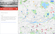
| Hills of Watertown, Mass. |
| | Hills | More about Watertown's USGS-listed hills | Maps | Sources | |
| Cedar Hill |
|
| Church Hill |
|
| Clay Hill |
|
| Coolidge Hill |
|
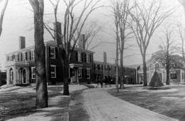
| Coolidge Hill (historic) |
| • |
Google Maps | Google Earth - Google Maps |
| • |
"...Several prominent hills (e.g., Whitney Hill, Strawberry Hill, and Coolidge Hill) dot the landscape..." - Open Space Plan 2005, pg 21 |
| • |
Coolidge Hill Rd area topographic. - 1946 Historical USGS, MapJunction |
| • |
"...John Coollidge, b. 1604, d. 1691. Wife Mary, D. Aug 22. 1691, aged 88. One of the earliest proprietors of Watertown, Mass. He came from Cambridgeshire, England. The date of his arrival is uncertain, probably toward 1630..." - Genealogy of Some of the Descendants of John Coolidge of Watertown, Mass., 1630. - Internet Archive |
| • |
"...The homestead of John Coolidge was upon the highlands at the northwesterly side of Fresh Pond, and he acquired other lands in different localities..." - Hurd, pg 427, 1890 - Internet Archive |
| • |
Coolidge School, "...The Coolidge name had a long and proud history in Watertown. Early settlers John Coolidge and his wife Mary emigrated from England in 1636...Members of the Coolidge family held large tracts of land in Watertown, much of it surrounding the current site of the Coolidge School...." - Massachusetts Cultural Resource Information System (MACRIS) |
| • |
Earlier name: "...John, the youngest son of William Coolidge, of Cottenham, Cambridge County, England (baptized September 16, 1604), was perhaps one of the first settlers of Watertown, in 1630, although the date of his arrival has not been ascertained...", Whitney, pg. 426, 1893 - Internet Archive |
| • |
John Calvin Coolidge, Jr., the 30th President of the United States, was a descendant of John Coolidge (1604-1691) of Watertown, Mass. - Wikipedia |
| • |
Coolidge Hill - USGS Geographic Names Information System |
|
| Elbow Hill |
| • |
Google Maps | Google Earth - Google Maps |
| • |
"...Elbow Hill is sometimes mentioned in the description of roads, and was probably nothing more than a declivity
in Lexington Street, at first called the Concord Road...", Bond, pg. 1031 - Internet Archive |
| • |
"...This was the "Old Concord Road." Its first well-defined change of level marks the summit of ' Elbow Hill.' The new road goes through the top of the hill, the old one went around it, and only a little unevenness in the turf shows the bounds of the original thoroughfare...", Hurd, pg, 692, 1890 - Internet Archive |
|
| Fountain Hill |
| • |
Google Maps | Google Earth - Google Maps |
| • |
"...Above Fountain Hill was Oakley, the Harrison Gray Otis estate (now the Oakley Country Club, one of the old est golf courses in America)....", Robinson, Wheeler, pg. 79 (PDF), 1930 - Internet Archive |
| • |
"...West of the fertile farms, on the rising ground of Meeting-House Hill, was the beautiful estate of Fountain Hill. The house itself stood on the slope west of School Street. Fountain Hill was built by Charles Davenport... He sold the estate in 1860 to Alvin Adams, founder of the Adams Express Company, who enlarged the property...", Robinson, Wheeler, pg. 78 (PDF), 1930 - Internet Archive |
|
| Harvard Hill |
|
| Juniper Hill |
|
| Laurel Hill |
|
| Learneds Hill |
| • |
Google Maps | Google Earth - Google Maps |
| • |
"...These streams are the drainage channels of the watershed bounded by the rising ground on which Mt. Auburn street is located, from Beacon square to Learned's hill on the east, Meeting House hill and the adjoining high grounds on the north..." - Watertown 1902 Annual Report (PDF), pg. 54, - Watertown Public Library |
| • |
"... or that portion which lies between Learned's Hill and Clay Hill on the east ..." - Report of the Engineer Appointed by the Town of Watertown on the Subjects of Drainage and Sewerage, pg. 53, - Google ebook |
| • |
Home site of S. Learned. Map of Watertown, Mass., 1850 - Digital Commonwealth |
| • |
Home site of S. S. Learned. Watertown Map. Middlesex County 1875, Massachusetts, F.W. Beers, 1875 - Historic Map Works |
| • |
The Learned family (Learned, Larned, Learnard, Larnard and Lerned) Being Descendants of William Learned, William L. Learned, 1882 - Internet Archive |
| • |
The Learned family in America, 1630-1967, Eugenia Learned James, 1967 - Internet Archive |
|
| Lowell School Hill |
| • |
Google Maps | Google Earth - Google Maps |
| • |
Lowell School Hill, Parks & Playgrounds (Doc), Town of Watertown Open Space and Recreation Plan, 2005, pg. 41 |
| • |
Lowell School Hill - Open Street Map |
| • |
James Russell Lowell - Wikipedia |
| • |
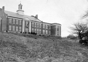
"...The James Russell Lowell School opened in September 1927. It was named after James Russell Lowell, poet and United States Ambassador to England and, at a later date, Spain.... James Russell Lowell lived near Longfellow House in Cambridge but made frequent visits to
Watertown, as his wife Maria (White) Lowell was a Watertown native. His description of a winter brook
in 'The Vision of Sir Launfal” is said to have been inspired by a brook in Watertown.'..." - James Russell Lowell Elementary School, Family Handbook, 2006 (PDF), pg. 4, - Watertown Public Schools |
|
| Meetinghouse Hill |
| • |
MassGIS identified - Oliver MassGIS Online Mapping Tool |
| • |
Google Maps | Google Earth - Google Maps |
| • |
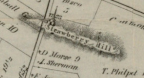
"...The first is Strawberry Hill, repeatedly
mentioned in the early schedules of possessions. There has been much perplexity
and uncertainty, as to its locality; whether it was identical with Schoolhouse Hill,
or was situated farther north, near the Cambridge Line, or a little west of Fresh
Pond...", Bond, pg. 1030, 1855 - Internet Archive |
| • |
"...1665... granted that John Sherman; hath liberty to Fence vp the end of the lane (that run by his houfe) next Strabury hill (att his owne coft & charge) prouided he hainge a Convenient gate for Cart horfs or Foott to pafs ; or Drifft of Cattell...", Watertown Records, pg. 85, 1894 - Internet Archive |
| • |
"...The hill mentioned here [School-house Hill] bore this name for a long time. It is now called Meeting-house Hill...", Francis, pg. 70, 1830 - Internet Archive |
| • |
"...It is not certain how soon after the settlement of Watertown in 1630, provisions were made for the education of her youth, but the earliest recorded date of a school-house is September 17, 1649. This was a small, one-storied building situated on Strawberry Hill, which afterwards bore the name of School-House Hill, now thought to be identical with Meeting-House Hill...", Whitney, Hurd, pg. 353, 1890 - HathiTrust |
| • |
"...while Strawberry Hill is somewhat more than 250 feet high. This was afterwards called School-House Hill, and after the church was erected there, Meeting-House Hill, and is the hill now marked by the beautiful half-brick residence of Gilbert R. Payson, which is visible from all the hill-tops, and many of the housetops
within ten miles of Boston...", Whitney, Hurd, pg. 322, 1890 - HathiTrust |
| • |
"...One such estate located on Common Street Hill (also known as Strawberry Hill) was that of the Otis family of Boston; this estate was later renamed “The Oakley” for the numerous oak trees that dotted the estate’s forty-five acres. Today the remnants of the Oakley estate are part of the Oakley Country Club..." - Open Space Plan 2005, pg 11 (PDF) |
| • |
"...The new Otis property was on Strawberry or Common Street Hill, the highest point in town, and, the house was enlarged under the supervision of Bulfinch and renamed The Oakley...
..."Oakley" as a name was suggested by the abundance of oak trees in the vicinity (now called Waverley Oaks). Twenty-six of them predated any American settlement, and it is said that when one of them fell it showed evidence of being eight hundred years old...", Hodges, pg. 80 (PDF), 1980 - Histories & Highlights, Watertown Free Public Library |
| • |
"...By the late 1890s garden estates were being divided into house lots. Oakley became one of the first golf courses in the country. Its western end was purchased by Gilbert Payson, whose family had made its fortune from New Hampshire textile mills. He moved the Otis-Pratt barn nearer to his stone mansion, and both buildings later became
part of Mount Trinity Academy...", Hodges, pg. 146 (PDF), 1980 - Histories & Highlights, Watertown Free Public Library |
| • |
"...except to the higher portions of Meeting-House or Payson's Hill...", Whitney, pg. 322, 1893 - Internet Archive |
| • |
"...One such estate located on Common Street Hill (also known as Strawberry Hill) was that of the Otis family of Boston; this estate was later renamed “The Oakley” for the numerous oak trees that dotted the estate’s forty-five acres. Today the remnants of the Oakley estate are part of the Oakley Country Club..." - Open Space Plan 2005, pg 11 (PDF) |
| • |
Payson House on Oakley Hill, "Payson House on Oakley Hill built in 1881, later it was the site of Mount Trinity Academy, then the Protestant Guild for the Blind. In 1984 it was transformed into condominiums. ...Gilbert Payson. for whom the mansion was built, made a fortune in the textile trade The family owned the house until around 1920. It is considered the highest point in Watertown..." - Digital Commonwealth |
| • |
"1808 - H. G. Otis Aquires Land on Strawberry Hill": - Oakley Through the Years, Oakley Hill Country Club |
| • |
Gilbert and Pratt Estates shown on map of Watertown, 1898 - Digital Commonwealth |
| • |
Meetinghouse Hill - USGS Geographic Names Information System |
|
| Mount Auburn |
|
| Pine Hill |
|
| Temple Hill |
|
| Whitney Hill |
| • |
MassGIS identified - Oliver MassGIS Online Mapping Tool |
| • |
Google Maps | Google Earth - Google Maps |
| • |
"...The ground is somewhat elevated, and there is little doubt that it is the " Whitney Hill " sometimes mentioned in the records—Dr. Bond thinking it very probable that his supposition, p. 1031, respecting this hill, is incorrect...", A Brief Account of the Descendents of John and Elinor Whitney, of Watertown, Mass., pg. 7, Henry A. Whitney, 1857 - Haithi Trust |
| • |
"...Whitney's Hill, is supposed to be the same which has of late been called
White's Hill...", Bond, pg. 1031, 1855 - Internet Archive |
| • |
Earlier name: "...One of the prominent men in Watertown in the early part of the century was Mr. Jonas White, who owned a large farm on which was a lovely hill, which is now standing and is still called White's Hill...", Whitney, pg. 426, 1893 - Internet Archive |
| • |
"The hill nearer the village formerly called Whitney's Hill, from the fact that John Whitney's Sr., and his sons were supposed to have owned the north and west sides of the hill, more recently called White's Hill...", Hurd, pg. 322, 1860 - Internet Archive |
| • |
"...There are few hills of any magnitude. Strawberry Hill and Whitney's Hill are mentioned in the old records. The former is the higliest land in the town, and is identical with School-house Hill, afterwards called Meeting-house Hill. Whitney's Hill is supposed to be that latterly known as White's Hill...", Drake, pg. 434, 1880 - Internet Archive |
| • |
"...Whitney's Hill, is supposed to be the same which has of late been called White's Hill. The homestall of John Whitney... At an early date, John Whitney, Sen., and his sons, had become proprietors on the north and west sides of this hill...", Bond, pg. 1031, 1860 - Internet Archive |
| • |
"...John Whitney ... embarked at London in April, 1635, then aged 35, with his wife Elinor, aged 30, and sons, ...and immediately settled in Watertown. He purchased a 16-acre homestall...before 1642 the Town had granted him nine other lots of land, amounting to 198 acres...", A Brief Account of the Descendents of John and Elinor Whitney, of Watertown, Mass., pg. 5, Henry A. Whitney, 1857 - Haithi Trust |
| • |
Abijah White house, "...The estate went from Main and Whites' Avenue to and including Whitney Hill, then known as White's Hill..." - Digital Commonwealth |
| • |
Whitney Hill - USGS Geographic Names Information System |
|
|
|
 |
|
 |
|
 |
|
 |
|
| Church Hill |
 |
|
| Fountain Hill |
 |
|
 |
|
| Lowell School Hill |
 |
|
 |
|
| Meetinghouse Hill |
 |
|
| Mount Auburn |
 |
|
 |
|
 |
|
 |
|
| Whitney Hill |
 |
|
| |
| |
|
|
| More about Watertown's USGS-listed hills |
|
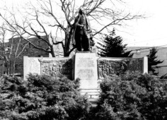
In the early 1930s the citizens of Watertown raised funds to erect a Founders’ Monument on the banks of the Charles River, proudly topping it with a statue of Richard Saltonstall (1586-1661). His descendants would become the Saltonstalls of Boston Brahmin fame, but Richard returned to England within a year reportedly because the winters were too cold. One of the panels on the monument is a bas-relief sculpture depicting an early scene of cooperation between the new colonists and Native Americans. The colonist in the center of the action is Roger Clapp (1609-1690). Much is known about him because he wrote a short memoir for his children about his voyage to New England as part the Puritan fleet lead by John Winthrop.1 He was a deeply religious man and much of the memoir extols his children to, “walk humbly with God. Be holy in all manner of conversation. Be courteous; be sober; be charitable; ready to distribute, given to hospitality.” And on the more practical side, “Abhor drunkenness, and excessive drinking. Come not into a tavern, but on just and weighty occasions.” |
|
The ship Clapp was a passenger on, the Mary & John, had arrived in the Massachusetts harbor before John Winthrop’s ship. Anxious to find a suitable place to establish a colony a small party of men including Clapp sailed up the Charles River, “until the river grew narrow and shallow.” The spot is thought to be near the Perkins School for the Blind. There is a monument on a bluff just above the river that described what happened. When the group of colonists disembarked they realized that there were 300 Native Americans near where they had set up camp. Matters could have deteriorated quickly, but one member of the party was an “old planter” who had a house in the area, traded with the Native Americans, and knew their language. The tense situation was defused and, as depicted in the panel, a Native American gave a bass to the colonists who returned the gesture with a gift of a biscuit (a small loaf of bread). The scene is also featured on the town seal of Watertown. Clapp didn’t stay long in Watertown either. He and his party returned to Dorchester in a few days. “Old planter” was a name given to a small group of men who, with their families or alone, were living along the Charles River before the Puritans arrived. It is thought that the “old planter” who helped the party of colonists was John Oldham (1592-1636).2 He had come to New England with the Pilgrims but was banished from that colony when letters he had written criticizing the leaders were intercepted and read. Oldham also had a rival claim to the area along the Charles River that could have been a problem for the newly arrived Puritans. Claims and counterclaims were made with Oldham eventually realizing that his wasn’t likely to prevail against the rapidly growing number of Puritans arriving, so he settled on 150 acres of land on the southern side of the Charles. Always more a trader than a colonist, Oldham was killed when he provoked a fight with Native Americans off Block Island after one his ship’s cargo was looted. None of the three candidates for a founder of Watertown stayed in the town long. |
| Watertown is one of the earliest towns named by the Puritans. On September 7th, 1630, only months after arriving, colony officials, still residing Charlestown, ordered, “…Trimountain be called Boston; Mattapan, Dorchester; and the town upon Charles River, Watertown.”3 The origin of the name Watertown has never been determined with complete confidence. As new towns were established in the Boston Basin, colonists would often name them after one they had left in England. But there is no Watertown in the Yorkshire area of England where Richard Saltonstall was from. It most commonly thought that the name is based simply on the abundance of fresh water the colonists found in the area. This especially true after they had to leave Charlestown because of the scarcity of fresh water. Other towns also would find an abundance of fresh water, but Watertown got the name first. |
| |
 |
| |
|
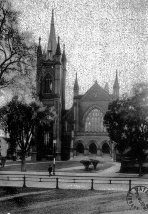
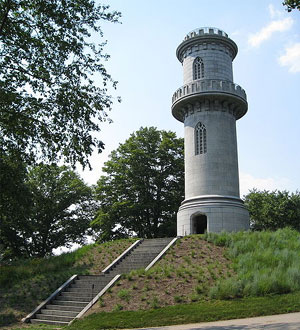
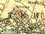
Watertown has four USGS-listed hills. The tallest, Meetinghouse Hill (223 ft.), has experienced multiple name changes over the years. The first settlers called it Strawberry Hill. Early town records have several mentions of the hill, such as this one from 1655 giving John Sherman permission to put up a fence, “next Strabury hill” provided he, “hainge a Convenient gate for Cart horfs or Foott to pafs ; or Drifft of Cattell.”4 Then it became School-House Hill when the town’s first school house was built there. The next name would be Meeting-House Hill. Where to put the meetinghouse was a controversial topic in the late 1600s. Watertown has grown from east to west with the original settlement by Richard Saltonstall now part of Cambridge. The next meetinghouse was built in today’s East Watertown. That was unsatisfactory to the people in West Watertown. They wanted the meetinghouse to be closer to them. A compromise was reached to build a new meetinghouse on top of School-House Hill. Still not satisfied, West Watertown shortly spilt off to become Waltham and built their own meetinghouse. The compromise meetinghouse fell into disuse as it was not in a convenient location for the rapidly growing population around today’s Watertown Square. They decided to build a new meeting house on the other side of the hill. Located on Common St., the same hill became known as Common-Street Hill. |
| |
 |
| |
|
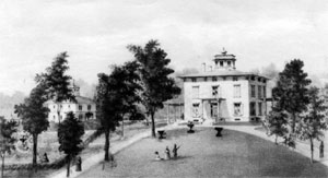
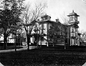
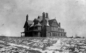
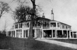
The next name given to Strawberry Hill came in 1808 when the farm house near its summit, and surrounding land, was purchased by Harrison G. Otis (1765-1848). The well-known businessman, lawyer, and politician became one of the wealthiest men in post-Revolutionary War Boston. For some members of this new class of elites simply owning a fabulous mansion in Boston was not enough (Otis over his lifetime would own three). They wanted to be able to escape the city in the summer with their families while still living in luxurious homes. Some of this elite class built mansions on the coast, others looked inland. In Waltham, Christopher Gore (1758–1827) built the Gore Place in 1793. Theodore Lyman (1753-1839) followed in 1798 with the construction of an estate he called The Vale. By 1809 Otis had a farm house he had bought in Watertown rebuilt and expanded by architect Charles Bulfinch. He named his estate Oakley after Oaks trees in the area. A golf club in 1898 would buy a portion of the property and continue to use the name. There are references to the location being called Oakley Hill. The last name for the hill came when the portion of the Otis estate at the summit was purchased by Gilbert R. Payson (1868–1939) in 1881. He made a fortune in the textile business and the mansion he built on the summit resulted in the hill being called by some, Payson’s Hill. The Meetinghouse Hill name would become what the USGS used after the hill was labeled that on a 1903 Boston topographic map. |
| The coordinates given for USGS-listed Coolidge Hill (52 ft.) puts its location in the southern portion of Mount Auburn Cemetery. The Cemetery is known for its seven hills, most no more than knolls, but Coolidge Hill is not one of them. Coolidge Hill appears on no USGS topographic map, nor on any other map, that is until the new USGS National Map appeared in 2015. The USGS-GNIS citation lists no geographic survey instead credits, like some other problematic hills in the Boston Basin, Aden T. Vaughan and his 1965 book, which doesn’t mention the hill. Both Watertown and Cambridge have valid claims to hills that could be called Coolidge Hill, but neither is where Vaughan locates it. Cambridge’s claim is based on Josiah Coolidge (1787-1874) purchasing a hill in 1821.5 He and his son kept a working farm on the hill until just after World War I. Watertown is the real home of the Coolidge’s dating to John Coolidge (1604-1691) who immigrated with his wife Mary (Ravens) Coolidge settling in Watertown.6 Many Coolidge descendants owned land in Watertown. The descendants of Calvin Coolidge (1872-1933), 30th President of the United States, left Watertown for Worcester before the Revolutionary War, and then moved to Vermont after the war. |
| |
 |
|
 |
| |
|
|
|
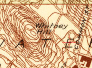
It’s not very often the USGS changes a name of a hill. Once a specific summit is labelled on one of their topographic maps, all later maps typically use that same name. But’s that not the case for Watertown’s USGS-listed Whitney Hill (184 ft.). On the 1903 USGS 1:62,500 map of Boston the hill is labelled Whites Hill. On the more detailed 1944 1:24,000 Newton map it’s become Whitney Hill. In this case, the confusion is understandable. The families of Whitneys, Whites, and Whitings have all owned and/or lived on land of the hill. The Whitney family was in Watertown first. John Whitney (1592-1673), his wife Elinor (____) (c.1598-1659), and their five children, the youngest one year old, immigrated to New England in 1635 settling in Watertown.7 They and their descendants have owned land on and around the hill. Though he wasn’t born of lived in Watertown, Eli Whitney (1765-1825), the inventor of the cotton gin, is one of the better-known descendants of John and Elinor. Another descendant, Solon Whitney (1868-1917), was the first librarian of the Watertown Free Pubic Library, a founder of the Watertown Historical Society, and wrote a history of the town. |
| |
 |
| |
|
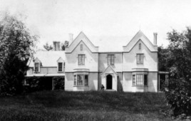
The White family was not in Watertown as early as the Whitneys, though they weren’t far behind. It’s recorded that Andrew White (1669-1742) married Sarah Sanderson (1668-1749) in Watertown in the late 1600s. Both were born in New England but is not clear when their ancestors immigrated. It is thought that they were likely part of larger wave people arriving in the mid-to-late-1600s when records were not kept as well as they were for the initial settlers. It would be a descendant of theirs, Abijah White (1779-1845), who would link the family name to the hill. He became one of the wealthiest men in Boston by raising cattle at farms he owned in the center of the state, butchering the beef in Brighton slaughterhouses, and then shipping it to ports in the Caribbean.8 White purchased a considerable amount of land in Watertown including Whitney Hill at the base of which in 1804 he built a mansion he named The Elms. Reports written at the time describe Abijah White as coarse and illiterate. In one account when John P. Cushing (1787-1862), the wealthy china merchant returned to Boston in 1830 and offered to buy what then called Whites Hill, Abijah responded, “Tell Cushing that if he should cover over the whole hill with Spanish milled dollars he can’t have it.” Paradoxically the Whites provided the best educational opportunities for their children. While Protestant, the Whites sent three of their daughters to the Catholic Ursuline Convent in Charlestown known for the quality of education offered to young women. That until it was burned down by a Protestant mob in 1834. The White’s only son, William Abijah White (1818-1856), would run afoul of mob mentality with fatal consequences.9 Harvard educated, a lawyer, William became very active in the temperance and abolition movements speaking for the anti-slavery cause with Frederick Douglas. Often threatened with violence when they travelled, William died mysteriously in Milwaukee, Wis., his body found much later at the bottom of a cliff by the lake. Foul play was suspected, but never proven. |
| |
 |
| |
|
The last of the wealthy men to own Whitney Hill before it was subdivided for houses was Nathaniel Whiting (1802-1871). The Whiting family dates back to Nathaniel Whiting (1609-1682) who immigrated to Lynn in 1638 and then settled in Dedham in 1641.10 His descendant, Nathaniel Whiting was a wealthy man in 1845 when he moved to Watertown to live in a mansion he had built on the south side of the hill. Not born to wealth, Whiting had worked his way up at trading companies in Boston until he was able to start own business.11 Later he was involved in real estate including being one of the lead financiers of the project which levelled Fort Hill in Boston for development in the late 1860s. Earlier he had been a partner in a company established to deepen the Charles River from Watertown to what was then called the Hancock Free Bridge, today’s dam near the Boston Science Museum. In 1870, shortly before he died, he was a partner in the establishment of the Watertown Savings Bank, still serving the town today. White married he first cousin, once removed, Rebecca Bullard (1819-1906), and they had four children. Their oldest son, Arthur Whiting (1845-1884) died in accident when he fell from a window at the Parker House hotel in Boston and broke his neck.14 There was very little coverage of what happened. In some histories of Watertown there is a mocking tone to the description of the Whiting’s other son, Dwight Whiting (1854-1907), as a California ostrich farmer.13 Yes, one of the ventures he owned in California was raising ostriches for their feathers that were the rage in women’s fashion at the time, and primarily imported from South Africa. Dwight Whiting was an early American land owner in California’s Orange County, moving to the state in 1874 after purchasing 10,000 acres. He was an enthusiastic promoter of the areas development, though not all his ventures were successful. He invested in the forestry of eucalyptus trees by planting many on this land. Eucalyptus wood from native-grown Australian trees was found to be excellent for the many railroad ties being laid. Unfortunately, when the wood from locally-owned trees was harvested, it was discovered that only wood from old growth trees made good railroad ties. Whiting was also a part of the effort to promote fruit growing in the area, including writing a book in 1893 titled, Fruit farming for profit in California.14 He is credited as being the founders of Lake Forest, Calif., then known as El Toro. His efforts persuaded the railroad company to route their new line through the town. That accomplishment was likely helped by the fact that his sister Anna Dwight Whiting (dates unknown) had married William H. Howard (1850-1901) in 1873. He was the eldest son of William D. M. Howard (1818-1856), a leading businessman and real estate investor in pre-gold rush San Francisco. There is no Whiting Hill in Watertown, but residents of Lake Forest can use the 2,500-acre Whiting Ranch Wilderness Park thanks to a gift from Dwight Whiting. |
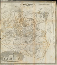
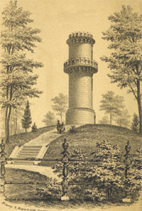
| USGS-listed Mount Auburn (128 ft.) shares its name with the cemetery established on the land around the hill in 1831. It was the first rural, country landscape-style cemetery in the United States. The hill was originally called Stone’s Hill, or Stone’s Mount, named for Simon Stone (1585-1665). He immigrated with his wife Joan Clarke (1596-1675) in 1635 settling in East Watertown. Their descendants would live and farm on the Stone homestead until the land was sold to be used for the new cemetery. The name Auburn is taken from a poem written by Oliver Goldsmith (c.1728-1774).15 The eccentric Irish poet, novelist, and playwright published a poem in 1770 titled, The Deserted Village. In it he laments the demise of rural villages that resulted when land which historically had been held common, was taken over by wealthy aristocratic families for use as private landscape gardens and nature preserves. The first line of the poem is, “Sweet Auburn! loveliest village of the plain”. The commonly told explanation on how the hill and the cemetery were named was that the term Sweet Auburn was used by Harvard students as early as 1801 to describe the quiet and secluded area of the Stone’s property near the river where they could go after classes to relax. |
| It is purely speculation, but there might be a link between the naming of Mount Auburn and Whites Hill, and that link is Abijah White’s wife, Ann Maria (Howard) White (1791-1849). As mentioned above, the usual suspects for the naming of Mount Auburn are Harvard students. Even a date of 1801 is sometimes given as though there was a naming ceremony. In the winter 2013 issue of Mount Auburn Cemetery’s own Sweet Auburn publication, the list of sources for the name is expanded, “praised in poetic verse by Harvard students and other local residents.”16 A 1918 article by Mrs. S.M. Gozzaldi on Gerry’s Landing provided an opinion on who those local residents were when she writes, “It was the Misses Howard who gave the name of Sweet Auburn to Stone’s Woods, afterwards changed to Mount Auburn when bought for a cemetery.”17 Mrs. S.M. Gozzaldi is actually Mary Isabella Gozzaldi, the wife of Silvio M. deGozzaldi. Here it was 1918 and a female author was not identified by her real name. It was only much worse for women more 100 years earlier. When it’s written that Harvard students named the area Sweet Auburn, it means Harvard men. Harvard didn’t offer degrees to women from Radcliffe College until 1963. |
| Even if it can’t be definitely proven that the “Misses Howard” did not first use the term Sweet Auburn to describe Stone’s Woods, Ann Maria Howard and her two sisters, Harriet (Howard) Fay (1782-1847) and Caroline (Howard) Gilman (1794-1888), are three remarkable women with sheer talent made a mark in a male-dominated society. Chronicling everything they did, and how they supported their children, is beyond the scope of a piece on Hills. There are highlights. The youngest of the three sisters, Caroline (Howard) Gilman, is probably best known for her poems and novels.18 Her daughter Caroline (Gilman) Jervey (1823-1877) wrote two novels.19 Two other daughters, Annie (Gilman) Bowen (1829-1903) and Eliza (Gilman) Dodge, Lippitt (1825-1903), each married Unitarian ministers and wrote hymns. For the oldest Howard sister, Harriet (Howard) Fay, less his known about her personal accomplishments. She married Samuel P.P. Fay (1788-1856), he a Middlesex county judge and Overseer of Harvard for many years. It is interesting to note that the Fay House, Radcliffe College’s first building, is named for Maria Denny Fay (1820-1890), Harriet’s youngest daughter.20 Like her sister Harriet, Ann Maria (Howard) White’s personal accomplishments are less known. Because of her family’s wealth, she and her home in Watertown seem to the social center for much social and literary activities. Just sending three of her girls to the Catholic Ursuline Convent was a strong statement that women should get a good education. Maria (White) Lowell (1821-1853) is the best known of the White daughters.21 She was a noted poet and married another James R. Lowell (1819-1891). Less is known of Lois Lilley (White) Howe (1825-1911) and Agnes (White) Devens (1829-1865), though likely very intentionally done, both portraits the Watertown Free Public Library has of the two women, show them holding books.22 |
|
|
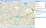
| Watertown Maps |
| • |
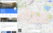
Watertown - Google Maps, Terrain |
| • |
Watertown - OLIVER: MassGIS's Online Mapping Tool |
| • |
Watertown - USGS - The National Map |
| • |
Lexington Quadrangle - 2018 (60 MB PDF) - USGS Topo Download |
| • |
Natick Quadrangle - 2018 (60 MB PDF) - USGS Topo Download |
| • |
1890 Topographicsl Atlas of Massachusetts,
Boston Sheet - Library of Congress, David Rumsey |
| • |
Map of Watertown, Mass. Surveyed by Order or the Town, 1850 - Library of Congress |
| • |
Plan of Watertown, the colored portion showing the part proposed to be taken from it for the town of Belmont, 1853 - Watertown Public Library, Digital Commonwealth |
| • |
Map of Middlesex County, Mass., Henry F. Walling, 1856 - Library of Congress |
| • |
A Map of the Original Allotments of Land and the Ancient Topography of Watertown Proper, Henry Bond, 1855-1860 - Watertown Public Library, Digital Commonwealth |
| • |
Map of the Town of Watertown, Middlesex Co., Mass., from Actual Surveys, J.B. Beers & Co., 1874 - Norman Leventhal Map Center, Boston Public Library |
| • |
Antique map of Watertown, Massachusetts 1875 Middlesex Atlas, - Community Heritage Maps |
| • |
Watertown, Atlas of Middlesex County, Volume 1, published by Geo. W. Stadly & Co., 1900 - State Library of Massachusetts |
| • |
Watertown Maps - Watertown Free Public Library |
| • |
Historical Map of Watertown, 1630-1930, Mary B. Hotz, 1930 - Norman Leventhal Map Center, Boston Public Library |
| • |
Mount Auburn, Avenues and Paths, Nathaniel Dearborn, 1848 - Norman Leventhal Map Center, Boston Public Library |
| • |
MapJunction |
|
|
| Watertown Sources |
| • |
An Historical Sketch of Watertown, in Massachusetts, from the First Settlement of the Town to the Close of its Second Century, Convers Francis, 1830 - Internet Archive |
| • |
Genealogies of the Families and Descendants of the Early Settlers of Watertown, Massachusetts, including Waltham and Weston, Henry Bond, 1860 - Internet Archive |
| • |
Genealogies of the Families and Descendants of the Early Settlers of Watertown, Massachusetts, including Waltham and Weston, Vol. 1, Genealogies, Henry Bond, 1855 - HathiTrust |
| • |
Genealogies of the Families and Descendants of the Early Settlers of Watertown, Massachusetts, including Waltham and Weston, Vol. 2 Additions, Corrections, and Early History, Henry Bond, 1855 - HathiTrust |
| • |
Genealogies of the Families and Descendants of the Early Settlers of Watertown, Massachusetts, including Waltham and Weston, 2nd Edition, Henry Bond, 1860 - Internet Archive |
| • |
Annals of an Ancient Parish, William H. Savage, New England Magazine: An Illustrated Monthly, Volume 6, pg. 237, 1892 - Google ebook |
| • |
Great Little Watertown, A Tercentenary History (PDF), G. Frederick Robinson and Ruth R. Wheeler, 1930 - Histories & Highlights, Watertown Free Public Library |
| • |
A Topographic History of Watertown (PDF), Charles T. Burke, 1975 - Watertown Public Library |
| • |
Crossroads on the Charles, A History of Watertown, Massachusetts (PDF), Mand D. Hodges, 1980 - Histories & Highlights, Watertown Free Public Library |
| • |
Watertown, History of Middlesex County, Massachusetts: Containing Carefully Prepared Histories of Every City and Town in the County, Samuel A. Drake, 1880, Vol. 2 - Internet Archive |
| • |
Historical Sketches of Watertown, Massachusetts, Solon F. Whitney, 1893 - Internet Archive |
| • |
Watertown, History of Middlesex County, Massachusetts, with Biographical Sketches of Many of its Pioneers and Prominent Men, Solon F. Whitney, Duane Hurd, 1890, Vol. 3 - HathiTrust |
| • |
Watertown, History of Middlesex County, Massachusetts: Containing Carefully Prepared Histories of Every City and Town in the County, Samuel A. Drake, 1880, Vol. 2 - Internet Archive |
| • |
Divided We Stand Watertown, Massachusetts, 1630-1680, Roger Thompson, 2001 - Google ebook preview |
| • |
Watertown, Images of America, Friends of the Watertown Free Public Library and Historical Society of Watertown, 2002 - Google ebook preview |
| • |
Watertown Local History & Genealogy - Watertown Free Public Library |
| • |
Watertown Histories & Highlights - Watertown Free Public Library |
| • |
Watertown Town Records - Watertown Free Public Library |
| • |
Watertown History & Tourism - Town of Watertown |
| • |
Watertown Houses, Buildings & Land - Town of Watertown |
| • |
Watertown Historical Society |
| • |
Watertown Comprehensive Plan Town of Watertown, MA, 2015 (PDF), - VHB |
| • |
Mount Auburn's Seven Hills - Mount Auburn Cemetery |
| • |
A Concise History of, and Guide through Mount Auburn, Nathaniel Dearborn, 1843 - Internet Archive |
| • |
Dearborn's Guide Through Mount Auburn, Nathaniel Dearborn, 1851 - Internet Archive |
| • |
A History of the Cemetery of Mount Auburn, Jacob Bigelow, 1860 - Internet Archive |
| • |
Mount Auburn Cemetery: Including Also a Brief History and Description of Cambridge, Harvard University, and the Union Railway Company, Moses King, 1883 - Google ebook |
|
|
| Footnotes |
| 1 |
The Memoir of Capt. Roger Clapp of Dorchester, ca. 1640 - The Winthrop Society |
|
Roger Clap visits Watertown, Dorchester Illustration of the Day no. 1923 - Dorchester Historial Society |
| 2 |
Murder on the Saltwater Frontier: The Death of John Oldham, Andrew C. Lipman, University of Pennsylvania Press, 2011 - JSTOR |
| 3 |
Annals of an Ancient Parish, William H. Savage, New England Magazine: An Illustrated Monthly, Volume 6, pg. 237, 1892 - Google ebook |
| 4 |
Watertown Records Comprising The First and Second Books of Town Proceesdings, pg.85, 1891 - Internet Archive |
| 5 |
The History of Coolidge Hill, Rosamond Coolidge, Cambridge Historical Society, Publications, Vol. 32, 1949 - Internet Archive |
| 6 |
Genealogy of some of the Descendants of John Coolidge of Watertown, Mass., 1630, Joseph Coolidge, Maeguerite Olivier, 1903 - HathiTrust |
| 7 |
A Brief Account of the Descendents of John and Elinor Whitney, Henry A. Whitney, 1857 - HathiTrust |
|
Whitney. The Descendants of John Whitney, who came from London, England, to Watertown, Massachusetts, in 1635, Frederick C. Pierce, 1895 - Internet Archive |
| 8 |
White, Abijah, heirs, The Rich Men of Massachusetts; Containing a Statement of the Reputed Wealth, pg. 132, 1852 - Google ebook |
|
James Russell Lowell's Father-in Law, The Evening Gazette, Vol. 1, no 162, 28 July 1883 - Illinois Digital Newspaper Collection |
| 9 |
William Abjah White, Necrology of Alumni of Harvard College, pg. 150, Joseph Palmer, 1864 - HathiTrust |
| 10 |
Whiting Genealogy, Nathaniel Whiting of Dedham, Mass., 1641, Theodore S. Lazell, 1902 - Internet Archive |
| 11 |
Nathaniel W hiting, TMemorial Biographies of the New England Historic Genealogical Society, Vol. 7, pg. 5, 1907 - HathiTrust |
|
Whitings Family of Dedham, Memoir of Rev. Samuel Whiting, D.D., pg. 282, 1873 - Google ebbok |
| 12 |
Whiting Genealogy, Nathaniel Whiting of Dedham, Mass., 1641, Theodore S. Lazell, 1902 - Internet Archive |
| 13 |
Just Who Was Dwight Whiting, Anyway?, Janet Whitcomb, Jun. 24, 2011 - Lake Forest Patch |
|
Who Is That Handsome Gent Looking Off Into the Distance?, Janet Whitcomb, Apr. 13, 2012 - Lake Forest Patch |
|
One of Dwight Whiting's Earliest Ideas Lays An Egg, Janet Whitcomb, Jul. 20, 2012 - Lake Forest Patch |
|
The Sudden Demise of Dwight Whiting, Janet Whitcomb, Jul. 27, 2012 - Lake Forest Patch |
| 14 |
Fruit Farming for Profit in California, Dwight Whiting, 1893 - Internet Archive |
| 15 |
Dr Oliver Goldsmith, J.H. Plumb - A Theory of Civilisation |
|
The Deserted Village, Oliver Goldsmith, 1885 - HathiTrust |
| 16 |
Sweet Auburn Magazine, Winter 2013, pg.1 (PDF), Sweet Auburn Magazines - Mount Auburn Cemetery |
| 17 |
Gerry’s Landing And Its Neighborhood, Mrs. S. M. Gozzaldi, Publications Vol. 13, 1918 - Cambridge Historical Society |
| 18 |
Recollections of a Southern Matron, Carolina (Howard) Gilman, 1852 - HathiTrust |
| 19 |
Caroline (Howard) Gilman Jervey - Encyclopedia.com |
| 20 |
All the Single Ladies: Deliberate Spinsterhood in the 19th Century, Susan Martin, The Beehive - Massachusetts Historical Society |
| 21 |
Biography of Maria White Lowell - PoemHunter.com |
|
Maria White Lowell, Leigh - Women's Testimonials Against Slavery: Abolitionist Poetry |
| 22 |
Lois Lilly White, Watertown Free Public Library - Digital Commonwealth |
|
Agnes Howard White, Watertown Free Public Library - Digital Commonwealth |
|
|