| Mattapan was the name of the village in Dorchester that grew up around the upper falls of the Neponset River. It became part of Boston when Dorchester was annexed in 1870. The name Mattapan originated from the Native American word Mattapanock, but there are conflicting accounts on what it means. To some, the word is translated as meaning, “A Sitting down place (for rest after a carry).” Others think the word means “evil spread about the place,” in reference to an epidemic that killed many Native Americans in the area. It was likely chosen by the settlers without knowledge of its significance.1 |
|
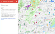
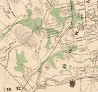
| Hills of Mattapan - Boston, Mass. |
| Babson-Cookson Tract |
| • |
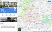
Google Maps | Google Maps - Google |
| • |
Beyond the Freedom Trail, Boston history rocks - The Boston Globe, "...More than 600 million years ago, some of what we now call Boston was part of a chain of volcanoes whose lava flows hardened into a rock called rhyolite. The volcano chain later fused with the North American continent, and the volcanoes eroded over time into more modest landscape features....", Boston Globe, Nov. 27, 2121 - Boston Globe (subscription) |
| • |
City moves to protect ancient Native American quarry in Mattapan "...The quarry is the source of an ancient volcanic stone prized for its banded maroon color and ideal qualities for making stone tools....", Nov. 2021 - Dorchester Reporter |
| • |
Rhyolite Quarry, Mattapan, "...The quarried face at left is about 40 ft high, or the same height as the trees that have grown up beside it since work ended. The quarry is part of a two-acre parcel known as the Babson-Cookson tract...", ophis, 2012 - Fluidr |
|
| Canterbury II |
|
| Franklin Hill |
| • |
Google Maps | Google Maps - Google |
| • |
Blue Hill Rock, "...Blue Hill Rock is a highly visible, buff-colored puddingstone ledge that extends back into Franklin Hill...This highly
fractured, heavily weathered puddingstone appears almost like rotted wood rather than stone, and the rusty brown color -- almost tan -- indicates a very high iron content. Severe cracks at steep angles suggest this rock may be on a fault line...", Boston Urban Wilds Report, pg. 97, Boston Natural Areas Fund, 1990 - Internet Archive |
|
| Wellington Hill |
| • |
USGS identified - MassMapper MassGIS |
| • |
Google Maps | Google Maps - Google |
| • |
Dorchester's Blue Hill Avenue, "...Wellington Hill was part of a large estate inherited by Wellington Holbrook, a well-off graduate of Harvard College with a sharp mind and a great sense of business. Holbrook inherited his Hill in the early 1900s, when Dorchester was just beginning to become a major residential neighborhood...
...Holbrook developed his land with a street plan and a number of multifamily dwellings, dubbing the new neighborhood "Wellington Hill" after himself...", 2012 - Boston Streetcars |
| • |
Wellington Hill, "...The rest of Wellington Hill in 1898 (within the survey boundaries) is a proposed development called Wellington Hill Park with dotted lines indicating-more or less-the street pattern that would be in place by 1910...", 2012 - Dorchester Athenum |
| • |
"...The development of Wellington Hill park, situated on Blue Hill Ave., Dorchester, is rapidly assuming great proportions....", Boston Globe, Jun. 1, 1898 - Boston Globe (subscription) |
| • |
Wellington Hill,"...Aside from the few farm houses situated on its lower slopes, residential
development of this area was relatively late, undoubtedly in part because of the difficulties of setting out streets
over steep and rocky upland terrain..." - Massachusetts Historical Commission Information System (MACRIS) |
| • |
Wellington Hill - USGS Geographic Names Information System |
|
| Willowwood Rock |
| • |
Google Maps | Google Maps - Google |
| • |
Willowwood Rock, "...A wooded mudstone outcrop lines the eastern boundary of the site...Mudstone, also called Cambridge argyllite, is normally found north of Boston as its name indicates. The presence of mudstone in this area is extremely unusual and seems to indicate that this area was once covered by water...", Boston Urban Wilds - City of Boston |
|
| Woodhaven |
| • |
Google Maps | Google Maps - Google |
| • |
Woodhaven, "...This site displays no fewer than four types of rock. It backs up to the right of way of the MBTA commuter rail lines. Along Woodhaven Street, between single-family houses, is a prominent outcrop of purple-gray Mattapan volcanic rock that has red and white oaks growing over it....At the rear of the Mattapan volcanic is a stone called breccia, often found in volcanics. This has purple-pink or ashen white pebbles in it like puddingstone. On the far side of the woods is a huge boulder of Roxbury puddingstone atop a cracked Mattapan volcanic, exactly as a glacier dumped it thousands of years ago...", Boston Urban Wilds Report, pg. 97, Boston Natural Areas Fund, 1990 - Internet Archive |
|
|
|
 |
|
| Wellington Hill |
 |
|
|
| Mattapan Maps |
| • |
Mattapan - Google Maps, Terrain |
| • |
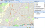
Mattapan - MassMapper MassGIS |
| • |
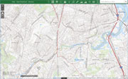
Mattapan - USGS - The National Map |
| • |
Boston South Quadrangle - 2018 (60 MB PDF) - USGS Topo Download |
| • |
Map of Dorchester Mass, Elbridge Whiting for S. Dwight Eaton, 1850 - Norman B. Leventhal Map Center, Boston Public Library |
| • |
A Map of the Towns of Dorchester and Milton, Edmund J. Baker, 1831 - Norman B. Leventhal Map Center, Boston Public Library |
| • |
Map of the City and Vicinity of Boston Massachusetts, James C. Sidney, 1853 - Norman B. Leventhal Map Center, Boston Public Library |
| • |
Plan of the Town of Dorchester, Thomas W. Davis, 1870 - Norman B. Leventhal Map Center, Boston Public Library |
| • |
Map of Boston, Showing Health Districts and Undrained and Drained Land, Heliotype Printing Co., 1879 - Norman B. Leventhal Map Center, Boston Public Library |
|
|