| Hills of Cambridge, Mass. |
| | Hills | More about Cambridge's USGS-listed hills | Maps | Sources | |
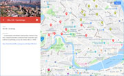
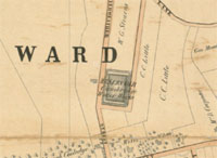
| Avon Hill |
| • |
Google Maps | Google Earth - Google |
| • |
Avon Hill: A Rose by Any Other Name (PDF), "...But in olden times you would have shuddered as you passed by and perhaps felt a chill, because then it was known as 'The Way to Gallows Hill.'...
... In the end, the answer to who chose the name may be lost to history, but it is certainly more attractive to potential residents than Gallows Hill...", Fall, 2012 - The Cambridge Historian, Cambridge Historical Society |
| • |
Avon Hill Historic District, "...Avon Hill, earlier known as Jones Hill, was first settled in 1638..." - Massachusetts Historical Commission Information System (MACRIS) |
| • |
Gallows Hill, The Ancient Place of Execution: "..It was up off the outer edge of the cow common on the easterly slope of the elevation known as Jones hill that the place of execution was located...", Thomas F. O'Malley, Cambridge Historical Society, Publications, Vol. 17, 1931 - Internet Archive |
|
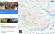
| Coolidge Hill |
| • |
Google Maps | Google Earth - Google |
| • |
The History of Coolidge Hill, "...Then in 1821, Josiah Coolidge of Watertown...bought the Thatcher-Gerry-Melville property, with the exception of the
Widow Orne's strip, and Josiah's family and heirs have lived there for one hundred and twenty-five years...", Rosamond Coolidge, Cambridge Historical Society, Publications, Vol. 32, 1949 - Internet Archive |
|
| Dana Hill |
| • |
USGS identified - MassMapper MassGIS |
| • |
Google Maps | Google Earth - Google |
| • |
"...Richard Dana, the first Dana to come to America, landed in New England about 1640, and was one of the early settlers in Cambridge, Massachusetts...", Tha Dana Family in America, pg. 35, Elizabeth E. Dana, 1956 - HathiTrust |
| • |
"...Richard Dana, who was also a counsellor and barrister at law, and the
father of Francis Dana, the most distinguished citizen of Cambridge in the period just after the Revolution. The Danas established themselves on what is now known as Dana Hill and built a homestead on the northwest corner of Massachusetts Avenue and Dana Street. ...", Eliot, pg. 73 - Internet Archive |
| • |
West Medford in 1870, "...In Cambridge a line of fortifications was constructed along the summit of Dana Hill, then called Butler's Hill...", Medford Historical Society Papers, Vol. 8, 1904 - Persus Digital Library |
| • |
Dana Hill, "..Some persons do nto see the propriety if calling such a slight elevation change a 'hill.'...
...…Early in the history of Cambridge, this was called ‘Butler’s Hill.’ Probably because in the early division of land in Cambridge, lots in this neighborhood were assigned to Richard and William Butler. It was also known as ‘Little Lot Hill’ from the fact that the lands here were laid out into small lots, while in other sections they were laid out into large lots…", Cambridge Chornicle, May 15, 1880 - Cambridge Public Library |
| • |
Dana Hill, "...At the same time, [Francis] Dana acquired the consolidated plots of Small Lot Hill and joined them to his recent purchase of the Goffe Estate to create Dana Hill..." - The Cambridge Room |
| • |
"...Continuing eastward, over what was then known as Butler's Hill, one passed Mr. Dana's house, set in the midst of orchards and cultivated grounds, and then came to Mr. Ralph Inman's estate, which was the last house in the direction of Boston and stood just back of where the City Hall now is.. ...", Eliot, pg. 73, 1913 - Internet Archive |
| • |
Dana Family, "...The Dana family is a Boston Brahmin family that arrived in Cambridge, Massachusetts from England during the later end of the Puritan migration to New England (1620–1640)..." - Wikipedia |
| • |
Francis Dana (1743-1811), "...In 1792, a company was formed [was a stockholder] to build a bridge to Cambridgeport over the Charles River.[2] This became the West Boston Bridge, later the site of the Longfellow Bridge that exists today...
...his son, Richard Henry Dana, Sr., was an important poet and literary critic as well as a lawyer. His grandson, Richard Henry Dana, Jr. (1815–1882) was a noted lawyer and author who served as U.S. Attorney for Massachusetts and wrote the classic Two Years Before the Mast...." - Wikipedia |
| • |
Our Butler Family, "...Another source states he sailed on the ship Hector in 1632 with his brother William. There are no passenger lists for that ship. Richard does appear on the records of Cambridge thus certainly did sail as part of one of Winthrop’s voyages...The Butler brothers both removed to Hartford, Connecticut with Rev. Hooker’s 'Braintree group', and he was therefore among the first settlers there. He was a deacon in the First Church of Hartford...." - Official Website of the River-Hopkins and Saemann-Nickel and Related Families |
| • |
Thomas Hooker, "...Called today 'the Father of Connecticut,' Thomas Hooker was a towering figure in the early development of colonial New England...." - Official Website of the River-Hopkins and Saemann-Nickel and Related Families |
| • |
Dana Hill - USGS Geographic Names Information System |
|
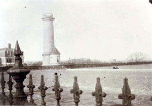
| Observatory Hill |
| • |
Google Maps | Google Earth - Google |
| • |
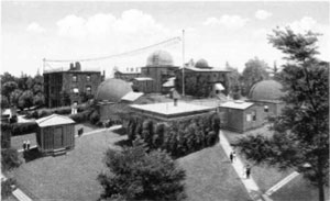
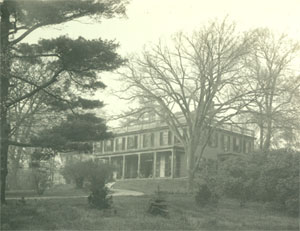
Dana: The Dana-Palmer House: "...In September, 1844, the instruments were moved from the former Dana House to the new Observatory which has remained duobservatoryring the century since that day on its present site, now called Observatory Hill...", Rosamond Coolidge, Cambridge Historical Society, Publications, Vol. 33, 1953 - Internet Archive |
| • |
Howe: The Story of a Lost Brook: "...Much of this land was owned by Andrew Craigie, and the Observatory built in 1844 was built on Craigie's Hill, where he had had a summer house. St. Peter's Church, across the turnpike, was dedicated in 1849....", Mrs. Edward S. King, Cambridge Historical Society, Publications, Vol. 31, 1948 - Internet Archive |
| • |
"...Harvard University Smithsonian Astronomical Observatory sits on the crest of the Moraine....", Moraine At Harvard - Boston Basin Geology |
| • |
Sears Tower - Harvard Observatory - Massachusetts Historical Commission Information System (MACRIS) |
|
| Otis Hill |
| • |
Google Maps | Google Earth - Google |
| • |
Cambridge Land Holdings: "...It is generally believed that Graves built the first house on Cambridge soil, situated on the southerly
slope of Otis Hill near the corner of Third and Spring Streets, East Cambridge...", Albert P. Norris, Cambridge Historical Society, Publications, Vol. 22, 1937 - Internet Archive |
| • |
"...The development history of Eastern Cambridge begins with local businessman and developer Andrew Craigie, who in 1795 bought up the few farms, marshlands, and grazing fields that made up the area. In partnership with Boston businessman Harrison Gray Otis, Craigie formed the Lechmere Point Corporation and built the Canal Bridge across the Charles River in 1809, adjacent to the site of the present Museum of Science. At the time, the Point was virtually an island with only a narrow connection to the mainland...", East Cambridge Planning Study (PDF), 2001 - City of Cambridge |
|
| Reservoir Hill |
|
| Shady Hill |
|
| Simonds Hill |
| • |
Google Maps | Google Earth - Google |
| • |
"...Mount Auburn Street was merely "the back road to Mount Auburn," with a delightful bathing place at Simond's Hill, behind what is now the hospital, -- an eminence afterwards carted away by the city and now
utterly vanished.....", Gilman, pg. 37, 1896 - Internet Archive |
| • |
Gerry's Landing and its Neighborhood: "...The eastern part of the bluff was called Simon's Hill; it has now been leveled.....the fourth generation of Simon Stone, whose grant of land in 1635 comprised twelve acres now included in the southerly part of Mount Auburn Cemetery, which was called Stone's Woods, and also running along the river bank, where Simon's Hill was named for him...", Mrs. S. M. Gozzaldi, Cambridge Historical Society, Publications, Vol. 13, 1925 - Internet Archive |
| • |
"...his eye would be caught by the bluff of Symond's hill, and, as naturally as did Saltonstall six hundred and thirty years later, he would anchor at Gerry's Landing. It also seems natural that he should set up his tents
for the first time...", The Landfall of Leif Erikson, A.D. 1000, pg. 147, Eben N. Horsford, 1892 - Internet Archive |
| • |
"...Mr. Samuel’s hill was where the Cambridge Hospital now is, and was so called for Samuel
Saltonstall who inherited the tract originally assigned to his father...", How the First Parish Church in Cambridge Got a New Meetinghouse, Frederick Robinson, 1927 - Cambridge Historical Society |
|
| Strawberry Hill |
| • |
Google Maps | Google Earth - Google |
| • |
"...Strawberry Hill’s natural hilly landscape and improved passenger transportation proved an asset for suburban development of the area. The “Strawberry Hill” residential subdivision was laid out in 1847 along the present-day Holworthy Street with a small oval park included to take advantage of the view of Fresh Pond......", Strawberry Hill Neighborhood Study 1999 (PDF) - City of Cambridge |
|
| Watch House Hill |
| • |
Google Maps | Google Earth - Google |
| • |
The History of Cambridge: Thomas Shepard: "...It was also then voted, and generally agreed, that the new meeting-house shall stand on the Watch house hill.” This is believed to be the hill on which the present congregational church stands....." - Havard Square Library |
| • |
"...a committee to build a new house, and a location was selected on what was known as the Watch House Hill, which was a slight elevation on what is now the southwest comer of the college yard, where Dane Hall stands...", Eliot, pg. 52, 1913 - Internet Archive |
| • |
"...In that year, 1650, the second meeting-house was built on Watchhouse Hill....", Gilman, pg. 236, 1896 - Internet Archive |
|
| Windmill Hill |
| • |
Google Maps | Google Earth - Google |
| • |
"...A palisaded wall, with a ditch, for defense against Indians and wolves, started at "Windmill Hill," or the present site of Ash Street....", Eliot, pg. 13, 1913 - Internet Archive |
| • |
"...The next way mentioned in the town records is under date of March 2, 1633/4, as follows: 'Granted John Benjamin all the ground between John Masters his ground and Antho Couldbyes, provided that the windmill hill shall be reserved for the Town use, and a Cartway of two Rods wide unto the same.'...", CHSP, vol. 14, pg. 33, 1926 - Internet Archive |
|
|
|
 |
|
 |
|
 |
|
 |
|
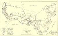
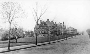
| Avon Hill |
 |
|
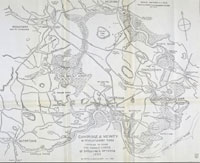
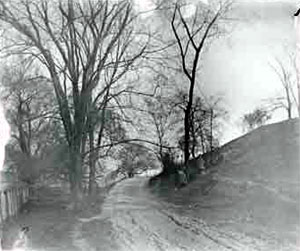
| Coolidge Hill |
 |
|
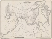
| Observatory Hill |
 |
|
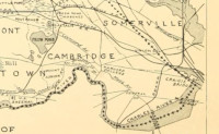
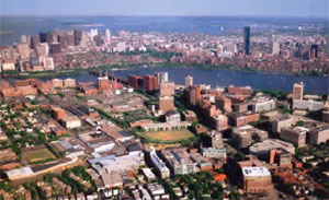
| Otis Hill |
 |
|
| Reservoir Hill |
 |
|
 |
|
| Shady Hill |
 |
|
|
|
| More about Cambridge's USGS-listed hills |
|
In 1630 Cambridge, not Boston, was selected to be the first capital of the Massachusetts Bay Colony. Called Newtowne at the time, the newly arrived Puritans feared that other groups with claims to the Bay territory would attack by sea. The location well up the Charles River was navigable to that point by a larger ship, but only through an easily defensible narrow channel. Changes in the political situation resulted in the capital moving between Boston and Newtowne until 1638 when the decision was made to keep the capital in Boston.1 |
| Newtowne included a much larger area than the present city of Cambridge, with various outlying parts becoming independent towns over the years: Cambridge Village (later Newtown and now Newton) in 1688, Cambridge Farms (now Lexington) in 1712, and Little or South Cambridge (now Brighton) and Menotomy or West Cambridge (now Arlington) in 1807. |
| Cambridge has one USGS-listed hill, Dana Hill (46 ft.). Richard Dana, the first Dana to come to America, landed in New England about 1640, and was one of the early settlers in Cambridge, Massachusetts. The hill was earlier known as Butler’s Hill, for Richard and William Butler. They had emigrated possibly as early as 1632 as part of one of Winthrop’s voyages. The brothers both removed to Hartford, Conn. before 1640 with Rev. Thomas Hooker's group. He is known today as 'The Father of Connecticut,' |
|
|
| Cambridge Maps |
| • |
Cambridge - Google Maps, Terrain |
| • |
Cambridge - MassMapper MassGIS |
| • |
Cambridge - USGS - The National Map |
| • |
Boston North Quadrangle - 2018 (60 MB PDF) - USGS Topo Download |
| • |
Boston South Quadrangle - 2018 (60 MB PDF) - USGS Topo Download |
| • |
Lexington Quadrangle - 2018 (60 MB PDF) - USGS Topo Download |
| • |
Newton Quadrangle - 2018 (60 MB PDF) - USGS Topo Download |
| • |
Map of the City of Cambridge, Mass., Henry F. Walling, 1854 - Norman B. Leventhal Map Center, Boston Public Library |
| • |
Atlas of the City of Cambridge, Mass., G.M. Hopkins & Co., 1873 - State Library of Massachusetts |
| • |
Map of the City of Cambridge, City Engineer, 1899 - Norman B. Leventhal Map Center, Boston Public Library |
| • |
Cambridge & Vicinity in Revolutionary Times, 1777, Samuel F. Batchelder, Cambridge Historical Society, Publications, Vol. 13, 1925 - Internet Archive |
| • |
Plan Showing Cambridge Highways as Existing in the Year 1700, Lewis M. Hastings, 1919 - Harvard Map Collection |
| • |
Map of Middlesex County, Mass., Henry F. Walling, 1856 - Library of Congress |
| • |
MapJunction |
|
|
| Cambridge Sources |
| • |
The History of Cambridge, Abiel Holmes, 1801 - HathiTrust |
| • |
The Cambridge of Eighteen Hundred and Ninety-Six, Arthur Gilman, 1896 - Internet Archive |
| • |
History of Cambridge, Massachusetts,- 1630-1877, Lucius R. Paige, 1877 - Internet Archive |
| • |
The Records of the town of Cambridge, Massachusetts, 1630-1703, 1901 - Internet Archive |
| • |
A History of Cambridge, Massachusetts, 1630-1913, Samuel A. Eliot, 1913 - Internet Archive |
| • |
The Register Book of the Lands and Houses in the "New Towne" and the town of Cambridge, with the Records of the Proprietors of the Common Lands, being the Records Generally called "The Proprietors' Records", Edward J. Brandon, 1896 - Internet Archive |
| • |
Cambridge, History of Middlesex County, Massachusetts: Containing Carefully Prepared Histories of Every City and Town in the County, Samuel A. Drake, 1880, Vol. 1 - Internet Archive |
| • |
Cambridge, History of Middlesex County, Massachusetts, with Biographical Sketches of Many of its Pioneers and Prominent Men, Duane Hurd, 1890, Vol. 1 - Internet Archive |
| • |
An Historic Guide to Cambridge, Hannah Winthrop Chapter, Daughters of the American Revolution, 1907 - Internet Archive |
| • |
Cambridge Historical Society |
| • |
Cambridge Archives Project |
| • |
Cambridge Historical Society Publications - Internet Archive |
| • |
Cambridge, MHC Reconnaissance Survey Town Report (PDF), 1980 - Massachusetts Historical Commission |
| • |
Cambridge Open Space & Recreation Plan, (PDF) - City of Cambridge |
|
|
|
|