| Hills of the Boston Basin |
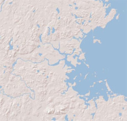
In the winter of 1631/1632 Massachusetts Bay Colony Governor John Winthrop was confident enough of the new colony’s survival to go exploring. The Puritan settlers had barely made it through their first winter in America almost running out of food. On January 27th Winthrop led a group of men up the Charles River “about eight miles above Watertown” on an expedition to plan a public road westward.1 After climbing the “high hills” west of Boston, likely in today’s Waltham, looking back the members of the Winthrop party would have noticed that their new home sat at the center of a wide roughly circular basin bordered on three sides by higher ground, and open to the ocean in the east. |
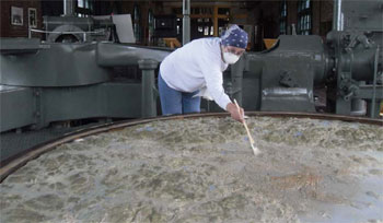
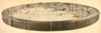
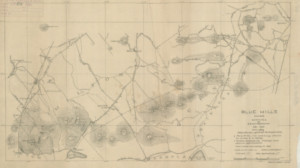
| A remarkable visualization of this Boston Basin was constructed by local sculptor George C. Curtis for the Paris Exposition of 1900.2 After being moved Museum of Science, in 2010 it was put on display at the Deer Island Treatment Plant Visitors Center. Thirty feet in circumference, and weighing a ton, the plaster topographical relief model represents five hundred square miles, with a diameter of twenty-five miles. Today, Route 128’s semicircular path around Boston roughly defines this basin and its borders, with Nahant in the north and Hull in the south not quite closing the circle. |
|
| The geology of the Boston Basin and its borders is complicated involving colliding continents, exotic terranes, mountain building, volcanoes, earthquakes, weathering, vaulting, erosion, deposition and glaciers.3 All this geologic activity has resulted in a diverse collection of hills, ledges, ridges, rocks, drumlins, kames, knolls, heights, and hummocks. Since the time of first contact with Native Americans, Europeans have been given these features names. Often times renaming them in later generations. |
|
Edward G. Chamberlain (1845-1935), a master surveyor and cartographer, and one of the Appalachian Mountain Club’s earliest members, studied and mapped the region in the late 1800s.4 When asking local people for the name of a specific hill, he would get “about as many names as there were families living near it.” As the country was expanding westward after the Civil War, inconsistencies and contradictions in the naming of geographic features was becoming a serious problem. In 1890, "to resolve all unsettled questions concerning geographic names," the U.S. Board on Geographic Names (BGN) was established.5 In 1947, its mission was expanded to "establish and maintain uniform geographic name usage throughout the Federal Government." |
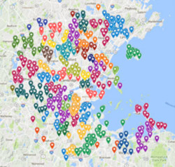
| Today, the BGN has over 30,000 features listed for just for Massachusetts in categories ranging alphabetically from airports to woods - no arroyos or oilfields in the state, but one arch and one levee. Looking at just the Boston Basin, and only including the categories; cliff, pillar, ridge, and summit, produces a list of about 200 geographic features. Most people will be able to name the “big three B-hills” in Boston, Beacon Hill, Bunker Hill, and the Blue Hills. History buffs will know of Breeds Hill where the Battle of Bunker Hill actually took place. Shoppers know of Chestnut Hill in Newton. Readers of crime stories will know Winter Hill in Somerville and it's notorious gang. But what about Baileys Hill in Nahant? Who was Bailey? Who were the Aspinwalls who have a hill after them in Brookline? Why is there a Sally Rock in Hyde Park? A Whispering Hill in Woburn? Why is a hill in East Boston called Orient Heights? |
| While a total of 200 hills for the relatively small Boston Basin sounds impressive, the real number of hills is much higher. For example, an 1832 map of Roxbury at the Boston Public Library’s Norman B. Leventhal Map Center, shows numerous hills in the area. However the BGN dataset lists only one, Scarboro Hill in Franklin Park. In Charlestown, revolutionary war maps show a Mortons Hill, School Hill, and Town Hill, but none are listed in the BGN dataset. Clearly, the total count of hills in the Boston Basin is much higher than the 200. |
| Why is the possessive apostrophe not used in the names of hills? |
| The BGN has an unusual policy when it comes to the naming of hills, the possessive apostrophe is always removed. While Breed’s Hill is almost universally the spelling of the famous hill in Charlestown, the BGN spells it Breeds Hill. Except in directly quoted material this naming convention is maintained on this website. Where did this policy come from? Even the BGN is unsure, . |
|
| There are exceptions, but only five, |
|
| |
|
| |
U.S. Board on Geographic Names - USGS |
| 1 |
Life and letters of John Winthrop, v. 2, pg. 104, Robert C. Winthrop, 1869 - HathiTrust |
| 2 |
Description of the Topographical Model of Metropolitan Boston, George C. Curtis, Commonwealth of Massachusetts, 1900 - Internet Archive |
| 3 |
The Geology and Early History of the Boston area of Massachusetts, A Bicentennial Approach, (PDF) Clifford A, Kaye, 1976 - United States Department of the Interior |
| 4 |
AMC's Master Mapmaker Edward Chamberlain, Hamlet Fort, 2015 - Appalachian Mountain Club |
| 5 |
Principles, Policies, and Procedures; Domestic Geographic Names (PDF), 2016, U.S. Board on Geographic Names |
|
|
|
|